

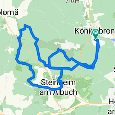
Brenz-Radweg - Von der Quelle zur Mündung
A cycling route starting in Königsbronn Abbey, Baden-Württemberg, Germany.
Overview
About this route
Vom Brenztopf, einer der typischen Karstquellen der Schwäbischen Alb, radelt man entlang der Brenz durch eine facettenreiche Landschaft bis zur Mündung der Brenz in die Donau. (Tourbeschreibung unter: thod_er@gmx.de)
- -:--
- Duration
- 59.1 km
- Distance
- 278 m
- Ascent
- 340 m
- Descent
- ---
- Avg. speed
- ---
- Avg. speed
Route quality
Waytypes & surfaces along the route
Waytypes
Quiet road
30.9 km
(52 %)
Track
9.9 km
(17 %)
Surfaces
Paved
49.3 km
(83 %)
Unpaved
5.9 km
(10 %)
Asphalt
44.4 km
(75 %)
Paved (undefined)
4.2 km
(7 %)
Continue with Bikemap
Use, edit, or download this cycling route
You would like to ride Brenz-Radweg - Von der Quelle zur Mündung or customize it for your own trip? Here is what you can do with this Bikemap route:
Free features
- Save this route as favorite or in collections
- Copy & plan your own version of this route
- Sync your route with Garmin or Wahoo
Premium features
Free trial for 3 days, or one-time payment. More about Bikemap Premium.
- Navigate this route on iOS & Android
- Export a GPX / KML file of this route
- Create your custom printout (try it for free)
- Download this route for offline navigation
Discover more Premium features.
Get Bikemap PremiumFrom our community
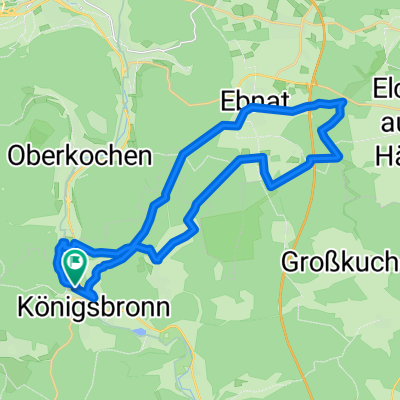
Other popular routes starting in Königsbronn Abbey
 Wentaltour
- Distance
- 26.8 km
- Ascent
- 372 m
- Descent
- 372 m
- Location
- Königsbronn Abbey, Baden-Württemberg, Germany
 Volkmarsbergtour
- Distance
- 19.8 km
- Ascent
- 491 m
- Descent
- 372 m
- Location
- Königsbronn Abbey, Baden-Württemberg, Germany
 Königsbronn - Wental - Steinheim - Königsbronn
- Distance
- 34.8 km
- Ascent
- 385 m
- Descent
- 356 m
- Location
- Königsbronn Abbey, Baden-Württemberg, Germany
 Steinheim_Wental
- Distance
- 29.8 km
- Ascent
- 402 m
- Descent
- 377 m
- Location
- Königsbronn Abbey, Baden-Württemberg, Germany
 Mitwoch-Abend-Tour 07.05.08
- Distance
- 30.2 km
- Ascent
- 294 m
- Descent
- 218 m
- Location
- Königsbronn Abbey, Baden-Württemberg, Germany
 Ziegelhütte - Weiherwiesen - Volkmasberg
- Distance
- 24.2 km
- Ascent
- 377 m
- Descent
- 395 m
- Location
- Königsbronn Abbey, Baden-Württemberg, Germany
 Wiesenseen,Lauterburg, Wental, Steinheim, Königsbronn
- Distance
- 45 km
- Ascent
- 626 m
- Descent
- 626 m
- Location
- Königsbronn Abbey, Baden-Württemberg, Germany
 Königsbronn, Aalbäumle, Heide
- Distance
- 33 km
- Ascent
- 612 m
- Descent
- 612 m
- Location
- Königsbronn Abbey, Baden-Württemberg, Germany
Open it in the app