

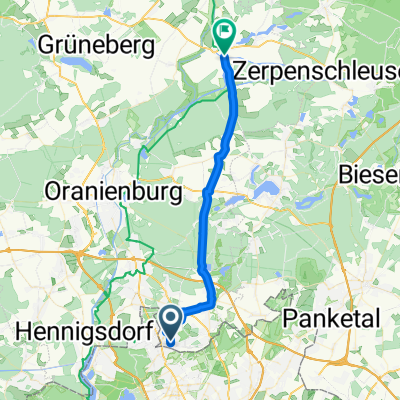
Briesetal - Oranienburg
A cycling route starting in Glienicke, Brandenburg, Germany.
Overview
About this route
- -:--
- Duration
- 46.7 km
- Distance
- 132 m
- Ascent
- 131 m
- Descent
- ---
- Avg. speed
- ---
- Avg. speed
Route quality
Waytypes & surfaces along the route
Waytypes
Quiet road
19.6 km
(42 %)
Path
12.2 km
(26 %)
Surfaces
Paved
32.6 km
(70 %)
Unpaved
7.2 km
(16 %)
Asphalt
27.7 km
(59 %)
Paving stones
3.6 km
(8 %)
Continue with Bikemap
Use, edit, or download this cycling route
You would like to ride Briesetal - Oranienburg or customize it for your own trip? Here is what you can do with this Bikemap route:
Free features
- Save this route as favorite or in collections
- Copy & plan your own version of this route
- Sync your route with Garmin or Wahoo
Premium features
Free trial for 3 days, or one-time payment. More about Bikemap Premium.
- Navigate this route on iOS & Android
- Export a GPX / KML file of this route
- Create your custom printout (try it for free)
- Download this route for offline navigation
Discover more Premium features.
Get Bikemap PremiumFrom our community
Other popular routes starting in Glienicke
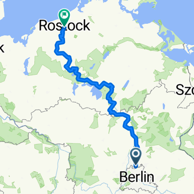
 Berlin-Potsdam-Henningsdorf-Berlin
- Distance
- 112.5 km
- Ascent
- 299 m
- Descent
- 299 m
- Location
- Glienicke, Brandenburg, Germany
 Glienicke-Zühlsdorf-Basdorf-Schönwalde-Glienicke
- Distance
- 34.5 km
- Ascent
- 112 m
- Descent
- 115 m
- Location
- Glienicke, Brandenburg, Germany
 Glienicke-Summt-Zehlendorf-Lanke-Bernau-Schönwalde-Glienicke
- Distance
- 61.3 km
- Ascent
- 186 m
- Descent
- 172 m
- Location
- Glienicke, Brandenburg, Germany
 Hermsdorf MV Schildow Lübars 18
- Distance
- 17.8 km
- Ascent
- 98 m
- Descent
- 101 m
- Location
- Glienicke, Brandenburg, Germany
 Route nach Mühlenbecker Land
- Distance
- 25.8 km
- Ascent
- 131 m
- Descent
- 130 m
- Location
- Glienicke, Brandenburg, Germany
 Glienicke-Summt-Zehlendorf-Lanke-Bernau-Schönwalde-Glienicke CLONED FROM ROUTE 135352
- Distance
- 61.3 km
- Ascent
- 135 m
- Descent
- 131 m
- Location
- Glienicke, Brandenburg, Germany
 Trainingsstrecke Glienicke-Liebenwalde
- Distance
- 30.9 km
- Ascent
- 58 m
- Descent
- 59 m
- Location
- Glienicke, Brandenburg, Germany
 Ostsee
- Distance
- 308.7 km
- Ascent
- 300 m
- Descent
- 332 m
- Location
- Glienicke, Brandenburg, Germany
Open it in the app