

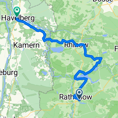
Rathenow - Grube - Bad Wilsnack
A cycling route starting in Rathenow, Brandenburg, Germany.
Overview
About this route
- -:--
- Duration
- 76.6 km
- Distance
- 88 m
- Ascent
- 88 m
- Descent
- ---
- Avg. speed
- ---
- Avg. speed

Route quality
Waytypes & surfaces along the route
Waytypes
Busy road
28.1 km
(37 %)
Cycleway
17.9 km
(23 %)
Surfaces
Paved
61.2 km
(80 %)
Unpaved
3.8 km
(5 %)
Asphalt
54.8 km
(72 %)
Paving stones
4.5 km
(6 %)
Continue with Bikemap
Use, edit, or download this cycling route
You would like to ride Rathenow - Grube - Bad Wilsnack or customize it for your own trip? Here is what you can do with this Bikemap route:
Free features
- Save this route as favorite or in collections
- Copy & plan your own version of this route
- Sync your route with Garmin or Wahoo
Premium features
Free trial for 3 days, or one-time payment. More about Bikemap Premium.
- Navigate this route on iOS & Android
- Export a GPX / KML file of this route
- Create your custom printout (try it for free)
- Download this route for offline navigation
Discover more Premium features.
Get Bikemap PremiumFrom our community
Other popular routes starting in Rathenow
 perm Kotzen
- Distance
- 65.6 km
- Ascent
- 166 m
- Descent
- 168 m
- Location
- Rathenow, Brandenburg, Germany
 Tour Brandenburg 1
- Distance
- 61.6 km
- Ascent
- 53 m
- Descent
- 54 m
- Location
- Rathenow, Brandenburg, Germany
 Rathenow, südliche Havel (groß)
- Distance
- 56.9 km
- Ascent
- 135 m
- Descent
- 136 m
- Location
- Rathenow, Brandenburg, Germany
 Hohennauener Straße 22, Rathenow nach Hohennauener Straße 22, Rathenow
- Distance
- 20.2 km
- Ascent
- 77 m
- Descent
- 79 m
- Location
- Rathenow, Brandenburg, Germany
 Abradeln 2017
- Distance
- 62 km
- Ascent
- 118 m
- Descent
- 118 m
- Location
- Rathenow, Brandenburg, Germany
 Rathenow-Müritz-Usedom
- Distance
- 238.7 km
- Ascent
- 248 m
- Descent
- 270 m
- Location
- Rathenow, Brandenburg, Germany
 Rathenow-Semlin-Hohennauen-Semlin-RN
- Distance
- 33.5 km
- Ascent
- 27 m
- Descent
- 24 m
- Location
- Rathenow, Brandenburg, Germany
 RTF Quer durch`s Havelland
- Distance
- 146.3 km
- Ascent
- 520 m
- Descent
- 517 m
- Location
- Rathenow, Brandenburg, Germany
Open it in the app