

Gäu- und Schönbuchrunde
A cycling route starting in Unterjettingen, Baden-Württemberg, Germany.
Overview
About this route
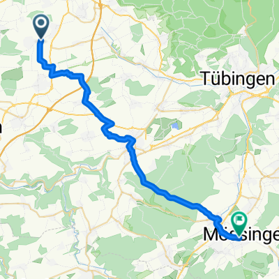
Gäufelden - Herrenberg - Breitenholz - Wurmlingen - Hailfingen - Gäufelden
- 2 h 39 min
- Duration
- 41.4 km
- Distance
- 307 m
- Ascent
- 307 m
- Descent
- 15.6 km/h
- Avg. speed
- ---
- Avg. speed
Route quality
Waytypes & surfaces along the route
Waytypes
Track
22.7 km
(55 %)
Quiet road
11.4 km
(28 %)
Surfaces
Paved
38.7 km
(93 %)
Unpaved
2.4 km
(6 %)
Asphalt
37.9 km
(92 %)
Loose gravel
1.3 km
(3 %)
Route highlights
Points of interest along the route
Point of interest after 21.9 km
Pause machen am Bach
Continue with Bikemap
Use, edit, or download this cycling route
You would like to ride Gäu- und Schönbuchrunde or customize it for your own trip? Here is what you can do with this Bikemap route:
Free features
- Save this route as favorite or in collections
- Copy & plan your own version of this route
- Sync your route with Garmin or Wahoo
Premium features
Free trial for 3 days, or one-time payment. More about Bikemap Premium.
- Navigate this route on iOS & Android
- Export a GPX / KML file of this route
- Create your custom printout (try it for free)
- Download this route for offline navigation
Discover more Premium features.
Get Bikemap PremiumFrom our community
Other popular routes starting in Unterjettingen
 Gaeufelder Lauf 2018 (2)
- Distance
- 7.8 km
- Ascent
- 79 m
- Descent
- 78 m
- Location
- Unterjettingen, Baden-Württemberg, Germany
 Jettingen - Rottenburg - Tübingen - Jettingen
- Distance
- 64.2 km
- Ascent
- 324 m
- Descent
- 322 m
- Location
- Unterjettingen, Baden-Württemberg, Germany
 Die kürzeste Radtour der Welt - Ultimative RSV "Ovale Tour"
- Distance
- 0.2 km
- Ascent
- 0 m
- Descent
- 0 m
- Location
- Unterjettingen, Baden-Württemberg, Germany
 Schönbuch-Rundfahrt_Juli-2011
- Distance
- 56.1 km
- Ascent
- 597 m
- Descent
- 586 m
- Location
- Unterjettingen, Baden-Württemberg, Germany
 Gäufelden-Binsdorf
- Distance
- 61.2 km
- Ascent
- 631 m
- Descent
- 519 m
- Location
- Unterjettingen, Baden-Württemberg, Germany
 Weg zur Arbeit
- Distance
- 30.1 km
- Ascent
- 308 m
- Descent
- 318 m
- Location
- Unterjettingen, Baden-Württemberg, Germany
 Rundreise Gäu
- Distance
- 23.6 km
- Ascent
- 229 m
- Descent
- 249 m
- Location
- Unterjettingen, Baden-Württemberg, Germany
 LILA LOGISTIK Charity Bike Cup - Gäufelden Öschelbronn
- Distance
- 12.9 km
- Ascent
- 144 m
- Descent
- 144 m
- Location
- Unterjettingen, Baden-Württemberg, Germany