

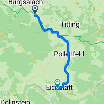
Anlautertal 54km
A cycling route starting in Raitenbuch, Bavaria, Germany.
Overview
About this route
- -:--
- Duration
- 53.8 km
- Distance
- 476 m
- Ascent
- 475 m
- Descent
- ---
- Avg. speed
- ---
- Avg. speed

Route quality
Waytypes & surfaces along the route
Waytypes
Track
23.6 km
(44 %)
Quiet road
17 km
(32 %)
Surfaces
Paved
32.1 km
(60 %)
Unpaved
21.1 km
(39 %)
Asphalt
31.6 km
(59 %)
Gravel
20.7 km
(38 %)
Continue with Bikemap
Use, edit, or download this cycling route
You would like to ride Anlautertal 54km or customize it for your own trip? Here is what you can do with this Bikemap route:
Free features
- Save this route as favorite or in collections
- Copy & plan your own version of this route
- Sync your route with Garmin or Wahoo
Premium features
Free trial for 3 days, or one-time payment. More about Bikemap Premium.
- Navigate this route on iOS & Android
- Export a GPX / KML file of this route
- Create your custom printout (try it for free)
- Download this route for offline navigation
Discover more Premium features.
Get Bikemap PremiumFrom our community
Other popular routes starting in Raitenbuch
 Anlautertal 54km
- Distance
- 53.8 km
- Ascent
- 476 m
- Descent
- 475 m
- Location
- Raitenbuch, Bavaria, Germany
 Eckerleinstraße, Raitenbuch nach Geländer 1, Schernfeld
- Distance
- 7.3 km
- Ascent
- 117 m
- Descent
- 138 m
- Location
- Raitenbuch, Bavaria, Germany
 Straße ohne Straßennamen, Raitenbuch nach Straße ohne Straßennamen, Weißenburg-Gunzenhausen
- Distance
- 7.1 km
- Ascent
- 211 m
- Descent
- 246 m
- Location
- Raitenbuch, Bavaria, Germany
 Husserweg 9, Raitenbuch nach Weißenburger Straße 6A, Eichstätt
- Distance
- 20.8 km
- Ascent
- 126 m
- Descent
- 295 m
- Location
- Raitenbuch, Bavaria, Germany
 Anlautertal - Altmühltal
- Distance
- 53.5 km
- Ascent
- 204 m
- Descent
- 376 m
- Location
- Raitenbuch, Bavaria, Germany
 Zeitfahren Budderercup SVM
- Distance
- 18.6 km
- Ascent
- 89 m
- Descent
- 146 m
- Location
- Raitenbuch, Bavaria, Germany
 Bechtal Aschbuch
- Distance
- 34.6 km
- Ascent
- 358 m
- Descent
- 342 m
- Location
- Raitenbuch, Bavaria, Germany
 Hauptstraße 40, Raitenbuch nach Geländer 1, Schernfeld
- Distance
- 8.9 km
- Ascent
- 126 m
- Descent
- 145 m
- Location
- Raitenbuch, Bavaria, Germany
Open it in the app