

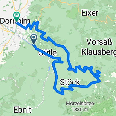
Loop Dornbirn -Hohenems -Altach -Koblach -Rheinauen -Flugplatz -Dornbirn
A cycling route starting in Dornbirn, Vorarlberg, Austria.
Overview
About this route
- -:--
- Duration
- 36.6 km
- Distance
- 97 m
- Ascent
- 98 m
- Descent
- ---
- Avg. speed
- ---
- Avg. speed

Route photos


Route quality
Waytypes & surfaces along the route
Waytypes
Quiet road
14.1 km
(39 %)
Track
5.6 km
(15 %)
Surfaces
Paved
32.7 km
(89 %)
Unpaved
3.1 km
(9 %)
Asphalt
32 km
(87 %)
Gravel
1.6 km
(4 %)
Continue with Bikemap
Use, edit, or download this cycling route
You would like to ride Loop Dornbirn -Hohenems -Altach -Koblach -Rheinauen -Flugplatz -Dornbirn or customize it for your own trip? Here is what you can do with this Bikemap route:
Free features
- Save this route as favorite or in collections
- Copy & plan your own version of this route
- Sync your route with Garmin or Wahoo
Premium features
Free trial for 3 days, or one-time payment. More about Bikemap Premium.
- Navigate this route on iOS & Android
- Export a GPX / KML file of this route
- Create your custom printout (try it for free)
- Download this route for offline navigation
Discover more Premium features.
Get Bikemap PremiumFrom our community
Other popular routes starting in Dornbirn
 Route in Dornbirn
- Distance
- 169.3 km
- Ascent
- 1,365 m
- Descent
- 1,364 m
- Location
- Dornbirn, Vorarlberg, Austria
 Dannerbruck- Kehlegg- Schwefel- Schauner- Schwendealp- und über Eisenharz retour zur Dannerbruck
- Distance
- 14.1 km
- Ascent
- 757 m
- Descent
- 708 m
- Location
- Dornbirn, Vorarlberg, Austria
 Gütle-Rappenloch-Kobel-retour
- Distance
- 16 km
- Ascent
- 546 m
- Descent
- 548 m
- Location
- Dornbirn, Vorarlberg, Austria
 Dannerbruck-Bühla Alp-Gräsa-Bregenzer Hütte-Bödele-Schwende-Eisenharz-Dannerbruck
- Distance
- 26.1 km
- Ascent
- 1,355 m
- Descent
- 1,352 m
- Location
- Dornbirn, Vorarlberg, Austria
 Dornbirn-Weissfluh-Kehlegg-Dornbirn
- Distance
- 30.1 km
- Ascent
- 968 m
- Descent
- 1,003 m
- Location
- Dornbirn, Vorarlberg, Austria
 Dannerbruck - Gütle - Niedere - Kobelalpe und retour
- Distance
- 19.5 km
- Ascent
- 571 m
- Descent
- 575 m
- Location
- Dornbirn, Vorarlberg, Austria
 Dannerbruck-Niedere-Kobel-Rudach-Rüttenen-Gechelbach-Dannerbruck
- Distance
- 17.9 km
- Ascent
- 1,092 m
- Descent
- 1,091 m
- Location
- Dornbirn, Vorarlberg, Austria
 alpe Schwende
- Distance
- 5.1 km
- Ascent
- 469 m
- Descent
- 18 m
- Location
- Dornbirn, Vorarlberg, Austria
Open it in the app