
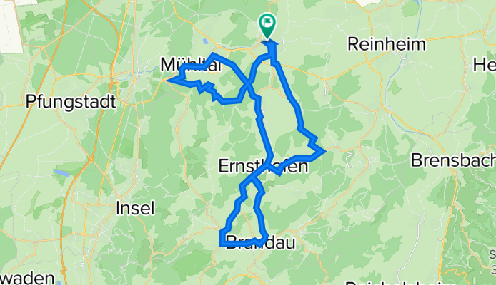
Tour durchs Modautal
A cycling route starting in Ober-Ramstadt, Hesse, Germany.
Overview
About this route
Schöne Tour im nördlichen Odenwald. Sehr hügeliges Gelände. Die Wegbeschaffenheit ist äußerst abwechslungsreich. Von der geteerten Kreisstraße bis zum grob geschotterten Waldweg ist alles dabei. Dennoch ist die Tour gut mit einem Trekkingrad zu machen. Ob e Bike oder Bio Bike das muss jeder für sich entsheiden. Auf jeden Fall sportlich. Das sieht man auch an den HM.
- -:--
- Duration
- 45.4 km
- Distance
- 888 m
- Ascent
- 891 m
- Descent
- ---
- Avg. speed
- ---
- Avg. speed

Route quality
Waytypes & surfaces along the route
Waytypes
Track
14.5 km
(32 %)
Busy road
10.2 km
(23 %)
Surfaces
Paved
22.3 km
(49 %)
Unpaved
14.6 km
(32 %)
Asphalt
20 km
(44 %)
Gravel
5.3 km
(12 %)
Continue with Bikemap
Use, edit, or download this cycling route
You would like to ride Tour durchs Modautal or customize it for your own trip? Here is what you can do with this Bikemap route:
Free features
- Save this route as favorite or in collections
- Copy & plan your own version of this route
- Sync your route with Garmin or Wahoo
Premium features
Free trial for 3 days, or one-time payment. More about Bikemap Premium.
- Navigate this route on iOS & Android
- Export a GPX / KML file of this route
- Create your custom printout (try it for free)
- Download this route for offline navigation
Discover more Premium features.
Get Bikemap PremiumFrom our community
Other popular routes starting in Ober-Ramstadt
 BT Burgruine Rodenstein
- Distance
- 37 km
- Ascent
- 482 m
- Descent
- 482 m
- Location
- Ober-Ramstadt, Hesse, Germany
 Gimme Five!
- Distance
- 65.2 km
- Ascent
- 1,059 m
- Descent
- 1,059 m
- Location
- Ober-Ramstadt, Hesse, Germany
 Fränkisch-Crumbach
- Distance
- 51.8 km
- Ascent
- 722 m
- Descent
- 721 m
- Location
- Ober-Ramstadt, Hesse, Germany
 Die sieben Odenwald-Schwestern
- Distance
- 90.4 km
- Ascent
- 1,540 m
- Descent
- 1,547 m
- Location
- Ober-Ramstadt, Hesse, Germany
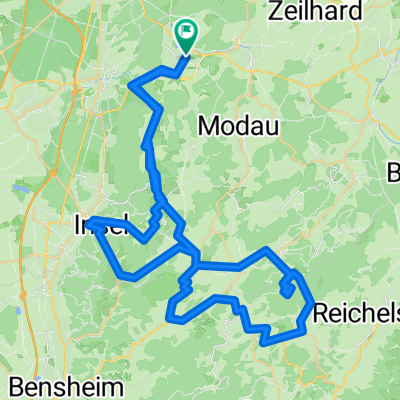
 Rundkurs Modau - Groß-Bieberau - Reinheim
- Distance
- 22.6 km
- Ascent
- 261 m
- Descent
- 261 m
- Location
- Ober-Ramstadt, Hesse, Germany
 Lichtenberger Schloss
- Distance
- 29.5 km
- Ascent
- 301 m
- Descent
- 289 m
- Location
- Ober-Ramstadt, Hesse, Germany
 Gemütliche Route in Ober-Ramstadt/Roßdorf/Fischerhütte
- Distance
- 22.1 km
- Ascent
- 505 m
- Descent
- 505 m
- Location
- Ober-Ramstadt, Hesse, Germany
 Rennradtour
- Distance
- 64.2 km
- Ascent
- 324 m
- Descent
- 324 m
- Location
- Ober-Ramstadt, Hesse, Germany
Open it in the app