
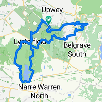
emerald
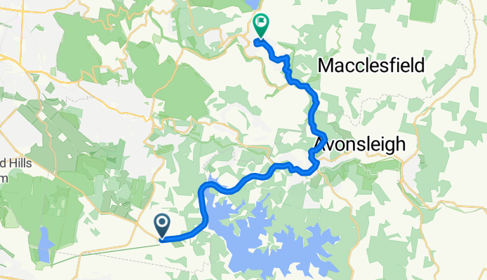
A cycling route starting in Belgrave South, Victoria, Australia.
Overview
About this route
- -:--
- Duration
- 20.1 km
- Distance
- 343 m
- Ascent
- 242 m
- Descent
- ---
- Avg. speed
- ---
- Avg. speed
Route quality
Waytypes & surfaces along the route
Waytypes
Busy road
16 km
(80 %)
Quiet road
1.5 km
(8 %)
Surfaces
Paved
16.2 km
(81 %)
Unpaved
2 km
(10 %)
Asphalt
16 km
(80 %)
Ground
1.3 km
(7 %)
Continue with Bikemap
Use, edit, or download this cycling route
You would like to ride emerald or customize it for your own trip? Here is what you can do with this Bikemap route:
Free features
- Save this route as favorite or in collections
- Copy & plan your own version of this route
- Sync your route with Garmin or Wahoo
Premium features
Free trial for 3 days, or one-time payment. More about Bikemap Premium.
- Navigate this route on iOS & Android
- Export a GPX / KML file of this route
- Create your custom printout (try it for free)
- Download this route for offline navigation
Discover more Premium features.
Get Bikemap PremiumFrom our community
Other popular routes starting in Belgrave South
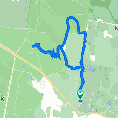
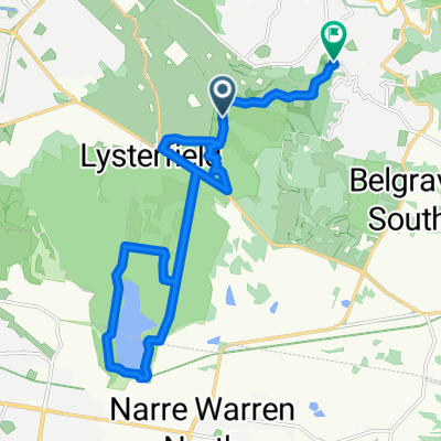 lysterfield easy trail
- Distance
- 19.5 km
- Ascent
- 361 m
- Descent
- 353 m
- Location
- Belgrave South, Victoria, Australia
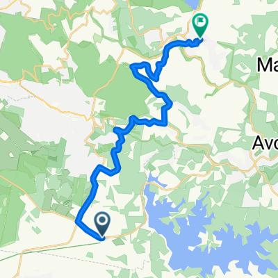
 glenfern
- Distance
- 41.9 km
- Ascent
- 685 m
- Descent
- 690 m
- Location
- Belgrave South, Victoria, Australia
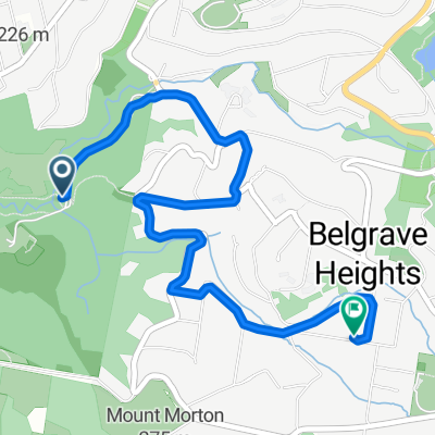 271D Mt Morton Road, Belgrave Heights to 35 Bartley Road, Belgrave Heights
- Distance
- 4.2 km
- Ascent
- 165 m
- Descent
- 78 m
- Location
- Belgrave South, Victoria, Australia
 glenfern
- Distance
- 35.9 km
- Ascent
- 631 m
- Descent
- 635 m
- Location
- Belgrave South, Victoria, Australia
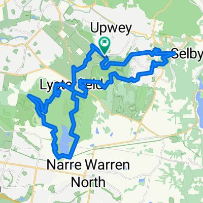
 Lengthy Morning Course In Upwey
- Distance
- 20 km
- Ascent
- 383 m
- Descent
- 338 m
- Location
- Belgrave South, Victoria, Australia
 Ryans Road 23, Lysterfield to Ryans Road 23, Lysterfield
- Distance
- 7.6 km
- Ascent
- 249 m
- Descent
- 257 m
- Location
- Belgrave South, Victoria, Australia
 the patch
- Distance
- 20 km
- Ascent
- 498 m
- Descent
- 390 m
- Location
- Belgrave South, Victoria, Australia
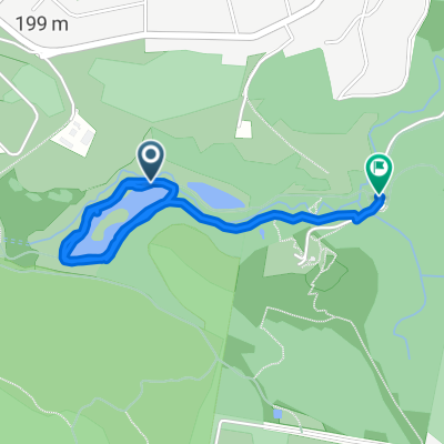 bird lands
- Distance
- 2.7 km
- Ascent
- 34 m
- Descent
- 28 m
- Location
- Belgrave South, Victoria, Australia
Open it in the app