

Ä£,È? nach Ä£,È?
A cycling route starting in Hombrechtikon, Canton of Zurich, Switzerland.
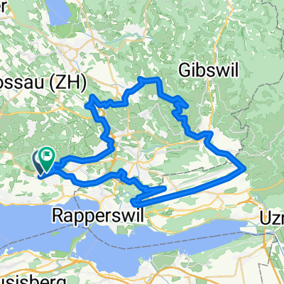
Overview
About this route
- 1 h 25 min
- Duration
- 26 km
- Distance
- 447 m
- Ascent
- 448 m
- Descent
- 18.3 km/h
- Avg. speed
- ---
- Avg. speed

Route quality
Waytypes & surfaces along the route
Waytypes
Quiet road
8.9 km
(34 %)
Track
5.8 km
(22 %)
Surfaces
Paved
17.9 km
(69 %)
Unpaved
5.9 km
(23 %)
Asphalt
17.4 km
(67 %)
Gravel
5.7 km
(22 %)
Continue with Bikemap
Use, edit, or download this cycling route
You would like to ride Ä£,È? nach Ä£,È? or customize it for your own trip? Here is what you can do with this Bikemap route:
Free features
- Save this route as favorite or in collections
- Copy & plan your own version of this route
- Sync your route with Garmin or Wahoo
Premium features
Free trial for 3 days, or one-time payment. More about Bikemap Premium.
- Navigate this route on iOS & Android
- Export a GPX / KML file of this route
- Create your custom printout (try it for free)
- Download this route for offline navigation
Discover more Premium features.
Get Bikemap PremiumFrom our community
Other popular routes starting in Hombrechtikon
 Hombrechtikon, Post nach Hüniweg 6, Meilen
- Distance
- 11.1 km
- Ascent
- 102 m
- Descent
- 182 m
- Location
- Hombrechtikon, Canton of Zurich, Switzerland
 Tagestour'18: ZürichseeRickenpassWattwilHemberg
- Distance
- 88.4 km
- Ascent
- 1,140 m
- Descent
- 1,145 m
- Location
- Hombrechtikon, Canton of Zurich, Switzerland
 Hombrechtikon - Hochwacht
- Distance
- 25.5 km
- Ascent
- 473 m
- Descent
- 473 m
- Location
- Hombrechtikon, Canton of Zurich, Switzerland
 02_RR_2014_Hombrechtikon - Einsiedeln
- Distance
- 42.2 km
- Ascent
- 924 m
- Descent
- 518 m
- Location
- Hombrechtikon, Canton of Zurich, Switzerland
 Passeio Magusto 14112015
- Distance
- 53.7 km
- Ascent
- 779 m
- Descent
- 782 m
- Location
- Hombrechtikon, Canton of Zurich, Switzerland
 RR_2014_Hombrechtikon_2
- Distance
- 42.4 km
- Ascent
- 905 m
- Descent
- 501 m
- Location
- Hombrechtikon, Canton of Zurich, Switzerland
 Single Trail Wald
- Distance
- 45.1 km
- Ascent
- 735 m
- Descent
- 734 m
- Location
- Hombrechtikon, Canton of Zurich, Switzerland
 Lützelsee Vorderer Pfannenstiel
- Distance
- 9.1 km
- Ascent
- 288 m
- Descent
- 70 m
- Location
- Hombrechtikon, Canton of Zurich, Switzerland
Open it in the app