

zur Tante Sabi
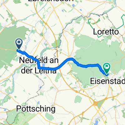
A cycling route starting in Ebenfurth, Lower Austria, Austria.
Overview
About this route
- 36 min
- Duration
- 4.7 km
- Distance
- 13 m
- Ascent
- 3 m
- Descent
- 7.9 km/h
- Avg. speed
- ---
- Avg. speed

Route quality
Waytypes & surfaces along the route
Waytypes
Busy road
1.7 km
(35 %)
Quiet road
1.2 km
(26 %)
Surfaces
Paved
1.3 km
(27 %)
Unpaved
0.6 km
(13 %)
Asphalt
1.3 km
(27 %)
Gravel
0.6 km
(13 %)
Undefined
2.8 km
(60 %)
Continue with Bikemap
Use, edit, or download this cycling route
You would like to ride zur Tante Sabi or customize it for your own trip? Here is what you can do with this Bikemap route:
Free features
- Save this route as favorite or in collections
- Copy & plan your own version of this route
- Sync your route with Garmin or Wahoo
Premium features
Free trial for 3 days, or one-time payment. More about Bikemap Premium.
- Navigate this route on iOS & Android
- Export a GPX / KML file of this route
- Create your custom printout (try it for free)
- Download this route for offline navigation
Discover more Premium features.
Get Bikemap PremiumFrom our community
Other popular routes starting in Ebenfurth
 Ebenfurth Zillingtal Pötsching Zillingdorf Eggendorf MTB
- Distance
- 27.3 km
- Ascent
- 166 m
- Descent
- 166 m
- Location
- Ebenfurth, Lower Austria, Austria
 Flurweg 2, Haschendorf nach Obere Edelmühle 1, Au am Leithaberge
- Distance
- 28.6 km
- Ascent
- 2,039 m
- Descent
- 2,052 m
- Location
- Ebenfurth, Lower Austria, Austria
 Route von Erholungszentrum 212, Haschendorf
- Distance
- 17.9 km
- Ascent
- 258 m
- Descent
- 205 m
- Location
- Ebenfurth, Lower Austria, Austria
 zur Tante Sabi
- Distance
- 4.7 km
- Ascent
- 13 m
- Descent
- 3 m
- Location
- Ebenfurth, Lower Austria, Austria
 Ebenfurth Trainingsrunde MTB
- Distance
- 14.7 km
- Ascent
- 25 m
- Descent
- 24 m
- Location
- Ebenfurth, Lower Austria, Austria
 Ebf-Willi-Sigleß
- Distance
- 18.9 km
- Ascent
- 68 m
- Descent
- 91 m
- Location
- Ebenfurth, Lower Austria, Austria
 RR 12.08.22
- Distance
- 38.9 km
- Ascent
- 350 m
- Descent
- 363 m
- Location
- Ebenfurth, Lower Austria, Austria
 Erholungszentrum 229, Haschendorf nach Ganghoferstraße 20, Kottingbrunn
- Distance
- 101.2 km
- Ascent
- 299 m
- Descent
- 276 m
- Location
- Ebenfurth, Lower Austria, Austria
Open it in the app