

zarys
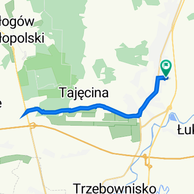
A cycling route starting in Wólka Podleśna, Subcarpathian Voivodeship, Poland.
Overview
About this route
zarys miejsc ktore trzeba odwiedzic, natomiast konkretne
- -:--
- Duration
- 140 km
- Distance
- 716 m
- Ascent
- 710 m
- Descent
- ---
- Avg. speed
- ---
- Avg. speed

Route quality
Waytypes & surfaces along the route
Waytypes
Quiet road
59.7 km
(43 %)
Road
58.6 km
(42 %)
Surfaces
Paved
119.7 km
(85 %)
Unpaved
2.4 km
(2 %)
Asphalt
117.5 km
(84 %)
Paved (undefined)
2.1 km
(1 %)
Continue with Bikemap
Use, edit, or download this cycling route
You would like to ride zarys or customize it for your own trip? Here is what you can do with this Bikemap route:
Free features
- Save this route as favorite or in collections
- Copy & plan your own version of this route
- Sync your route with Garmin or Wahoo
Premium features
Free trial for 3 days, or one-time payment. More about Bikemap Premium.
- Navigate this route on iOS & Android
- Export a GPX / KML file of this route
- Create your custom printout (try it for free)
- Download this route for offline navigation
Discover more Premium features.
Get Bikemap PremiumFrom our community
Other popular routes starting in Wólka Podleśna
 Do Lwowa p Korczowa
- Distance
- 168.2 km
- Ascent
- 466 m
- Descent
- 384 m
- Location
- Wólka Podleśna, Subcarpathian Voivodeship, Poland
 72A, Stobierna do Stobierna
- Distance
- 17.6 km
- Ascent
- 164 m
- Descent
- 107 m
- Location
- Wólka Podleśna, Subcarpathian Voivodeship, Poland
 stobierna-krzemienica-budziwoj
- Distance
- 48.5 km
- Ascent
- 98 m
- Descent
- 86 m
- Location
- Wólka Podleśna, Subcarpathian Voivodeship, Poland
 151/2, Pogwizdów do Brzóza Stadnicka
- Distance
- 15.8 km
- Ascent
- 132 m
- Descent
- 153 m
- Location
- Wólka Podleśna, Subcarpathian Voivodeship, Poland
 All in one
- Distance
- 20.4 km
- Ascent
- 47 m
- Descent
- 45 m
- Location
- Wólka Podleśna, Subcarpathian Voivodeship, Poland
 zarys
zarys- Distance
- 140 km
- Ascent
- 716 m
- Descent
- 710 m
- Location
- Wólka Podleśna, Subcarpathian Voivodeship, Poland
 Stobierna do 72A, Stobierna
- Distance
- 17.9 km
- Ascent
- 241 m
- Descent
- 150 m
- Location
- Wólka Podleśna, Subcarpathian Voivodeship, Poland
 Jasionka
- Distance
- 49.5 km
- Ascent
- 213 m
- Descent
- 214 m
- Location
- Wólka Podleśna, Subcarpathian Voivodeship, Poland