

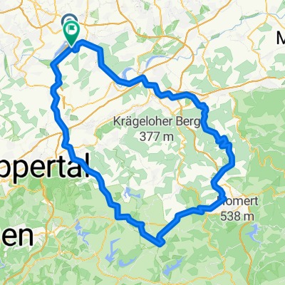
R04-Witten-Mülheim-74km
A cycling route starting in Witten, North Rhine-Westphalia, Germany.
Overview
About this route
- -:--
- Duration
- 74 km
- Distance
- 509 m
- Ascent
- 557 m
- Descent
- ---
- Avg. speed
- ---
- Avg. speed

Route quality
Waytypes & surfaces along the route
Waytypes
Path
36.6 km
(49 %)
Quiet road
14.7 km
(20 %)
Surfaces
Paved
67.7 km
(92 %)
Unpaved
5.6 km
(8 %)
Asphalt
59.2 km
(80 %)
Paving stones
6.4 km
(9 %)
Route highlights
Points of interest along the route
Point of interest after 0.2 km
Richtung Witten
Point of interest after 1.1 km
Germania-Denkmal von 1877. Siegerdenkmal zum Gedenken an die deutschen Einigungskriege(Deutsch-Dänischer Krieg von 1864, Deutscher Krieg von 1866 und Deutsch-Französischer Krieg von 1870/71)
Point of interest after 1.1 km
Gruben- und Feldbahnmuseum
Point of interest after 1.3 km
Schloss Steinhausen
Point of interest after 2.2 km
Zeche Nachtigall
Point of interest after 3.2 km
Ruhrtalfähre
Point of interest after 3.3 km
Ruine Hardenstein
Point of interest after 7.7 km
Kemnader See
Point of interest after 11.2 km
Haus Kemnade, Historisches Wasserschloss mit Museen u. Restaurant
Point of interest after 13.8 km
Dorfkirche Stiepel, einziger Kirchturm in NRW mit Fachwerk, innen großflächige Malereien
Point of interest after 22.4 km
Hattingen, sehenswerte historische Altstadt
Point of interest after 26.5 km
Burg Isenburg
Point of interest after 29.5 km
Schwimmbrücke Dahlhausen
Point of interest after 31.9 km
Eisenbahnmuseum Bochum-Dahlhausen
Point of interest after 32.1 km
Eisenbahnbrücke Dahlhausen
Point of interest after 41.5 km
Zeche Heinrich
Point of interest after 42.2 km
Gasthof Fährhaus "Rote Mühle"
Point of interest after 47.1 km
Baldeneysee
Point of interest after 50.9 km
Villa Hügel
Point of interest after 51.9 km
Stauwehr mit Laufwasserkraftwerk
Point of interest after 59.5 km
Kettwig, Altstadt mit schönen Fachwerkhäusern
Point of interest after 63.4 km
Ruhrtalbrücke, A 52, 1800m, längste stählerne Straßenbrücke in Deutschland
Point of interest after 69.9 km
Schloss Broich, Entstehungszeit 9. Jh. Die Befestigungsanlage ist in Teilen der älteste erhaltene frühmittelalterliche Wehrbau der späten Karolingerzeit.
Point of interest after 70.1 km
Schloßbrücke
Point of interest after 71.1 km
Mülheim Hbf
Point of interest after 71.9 km
Radschnellweg Rheinische Bahn
Point of interest after 72.9 km
Konrad-Adenauer-Brücke
Continue with Bikemap
Use, edit, or download this cycling route
You would like to ride R04-Witten-Mülheim-74km or customize it for your own trip? Here is what you can do with this Bikemap route:
Free features
- Save this route as favorite or in collections
- Copy & plan your own version of this route
- Sync your route with Garmin or Wahoo
Premium features
Free trial for 3 days, or one-time payment. More about Bikemap Premium.
- Navigate this route on iOS & Android
- Export a GPX / KML file of this route
- Create your custom printout (try it for free)
- Download this route for offline navigation
Discover more Premium features.
Get Bikemap PremiumFrom our community
Other popular routes starting in Witten
 Rechts und links der Ruhr (Wetter - Witten)
- Distance
- 46.9 km
- Ascent
- 921 m
- Descent
- 922 m
- Location
- Witten, North Rhine-Westphalia, Germany
 Grosse Muttentalrunde
- Distance
- 38.9 km
- Ascent
- 515 m
- Descent
- 515 m
- Location
- Witten, North Rhine-Westphalia, Germany
 Witten-Duisburg - Ruhrtal-Radweg -
- Distance
- 82.9 km
- Ascent
- 145 m
- Descent
- 202 m
- Location
- Witten, North Rhine-Westphalia, Germany
 18.10.2008 Matal Motion Bike Freunde Herbede
- Distance
- 38.2 km
- Ascent
- 363 m
- Descent
- 360 m
- Location
- Witten, North Rhine-Westphalia, Germany
 Rundkurs ums Autobahnkreuz Do-West
- Distance
- 19.9 km
- Ascent
- 93 m
- Descent
- 94 m
- Location
- Witten, North Rhine-Westphalia, Germany
 Do-Oespel - Sprockhövel - Do-Oespel
- Distance
- 45.7 km
- Ascent
- 344 m
- Descent
- 344 m
- Location
- Witten, North Rhine-Westphalia, Germany
 Lahmen Hasen V3
- Distance
- 109.4 km
- Ascent
- 842 m
- Descent
- 841 m
- Location
- Witten, North Rhine-Westphalia, Germany
 Wittentrails
- Distance
- 18.5 km
- Ascent
- 329 m
- Descent
- 329 m
- Location
- Witten, North Rhine-Westphalia, Germany
Open it in the app