

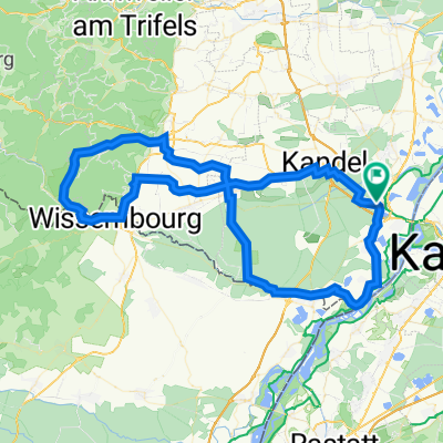
Albufer Karlsruhe - Epplesee - Rheindamm
A cycling route starting in Wörth am Rhein, Rhineland-Palatinate, Germany.
Overview
About this route
Eine Tour mit dem Ziel so lange wie möglich ab von der Straße im Grünen zu fahren.
Eine entspannende recht kurze Route beginnend und endend am Rhein, Eingeplante Pause am Seegugger am Epplesee. Auf / in der nähre der Route liegen auch noch: Eis-Oma'le Forchheim, Eiscafé Müller (Neuburg Weiher), etwas ab am Rhein nach Neuburg Weiher das restaurant Zollhaus & Rheinkiosk, das Naturfreundehaus Rappenwörth (Schnitzel sehr zu empfehlen). Start / Ende am Landgasthof Maxau.
- -:--
- Duration
- 37.4 km
- Distance
- 57 m
- Ascent
- 56 m
- Descent
- ---
- Avg. speed
- ---
- Avg. speed

Route quality
Waytypes & surfaces along the route
Waytypes
Path
12.7 km
(34 %)
Track
12.3 km
(33 %)
Surfaces
Paved
26.1 km
(70 %)
Unpaved
10.3 km
(28 %)
Asphalt
24 km
(64 %)
Gravel
7.6 km
(20 %)
Continue with Bikemap
Use, edit, or download this cycling route
You would like to ride Albufer Karlsruhe - Epplesee - Rheindamm or customize it for your own trip? Here is what you can do with this Bikemap route:
Free features
- Save this route as favorite or in collections
- Copy & plan your own version of this route
- Sync your route with Garmin or Wahoo
Premium features
Free trial for 3 days, or one-time payment. More about Bikemap Premium.
- Navigate this route on iOS & Android
- Export a GPX / KML file of this route
- Create your custom printout (try it for free)
- Download this route for offline navigation
Discover more Premium features.
Get Bikemap PremiumFrom our community
Other popular routes starting in Wörth am Rhein
 Knielingen-Rhein-Mühlburg-Knielingen
- Distance
- 15.2 km
- Ascent
- 34 m
- Descent
- 29 m
- Location
- Wörth am Rhein, Rhineland-Palatinate, Germany
 Deutsch-Französische Maifahrt 2010 - RTF des RSC Wörth 1980 e.V. - 133 km Strecke
- Distance
- 123.8 km
- Ascent
- 601 m
- Descent
- 601 m
- Location
- Wörth am Rhein, Rhineland-Palatinate, Germany
 Maximiliansau, Daxlanden, Neuburg
- Distance
- 24.5 km
- Ascent
- 43 m
- Descent
- 36 m
- Location
- Wörth am Rhein, Rhineland-Palatinate, Germany
 zum Schloßgarten und zum Brauhaus
- Distance
- 25.3 km
- Ascent
- 79 m
- Descent
- 80 m
- Location
- Wörth am Rhein, Rhineland-Palatinate, Germany
 Deutsch-Französische Maifahrt - RTF des RSC Wörth 1980 e.V. - 91 km Strecke
- Distance
- 88.8 km
- Ascent
- 305 m
- Descent
- 305 m
- Location
- Wörth am Rhein, Rhineland-Palatinate, Germany
 Deutsch-Französische Maifahrt 2010 - RTF des RSC Wörth 1980 e.V. - 164 km Strecke
- Distance
- 150 km
- Ascent
- 650 m
- Descent
- 650 m
- Location
- Wörth am Rhein, Rhineland-Palatinate, Germany
 Rhein Radweg 30Km Eben
- Distance
- 30.7 km
- Ascent
- 81 m
- Descent
- 83 m
- Location
- Wörth am Rhein, Rhineland-Palatinate, Germany
 Maxau, Wissembourg, Kandel, Maxau
- Distance
- 72.9 km
- Ascent
- 154 m
- Descent
- 150 m
- Location
- Wörth am Rhein, Rhineland-Palatinate, Germany
Open it in the app