

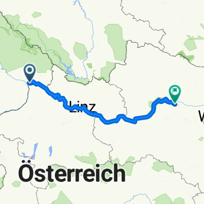
Passau - Schlögen
A cycling route starting in Schärding, Upper Austria, Austria.
Overview
About this route
Einer der schönsten Radwege Europas direkt an der Donau. Ebenfalls sehr leicht zu fahren. Ca. 4:00 Stunden Fahrzeit.
- -:--
- Duration
- 39.6 km
- Distance
- 138 m
- Ascent
- 167 m
- Descent
- ---
- Avg. speed
- 352 m
- Avg. speed

Route quality
Waytypes & surfaces along the route
Waytypes
Quiet road
10.2 km
(26 %)
Path
8.1 km
(20 %)
Surfaces
Paved
35.3 km
(89 %)
Unpaved
0.8 km
(2 %)
Asphalt
33.3 km
(84 %)
Concrete
1.9 km
(5 %)
Continue with Bikemap
Use, edit, or download this cycling route
You would like to ride Passau - Schlögen or customize it for your own trip? Here is what you can do with this Bikemap route:
Free features
- Save this route as favorite or in collections
- Copy & plan your own version of this route
- Sync your route with Garmin or Wahoo
Premium features
Free trial for 3 days, or one-time payment. More about Bikemap Premium.
- Navigate this route on iOS & Android
- Export a GPX / KML file of this route
- Create your custom printout (try it for free)
- Download this route for offline navigation
Discover more Premium features.
Get Bikemap PremiumFrom our community
Other popular routes starting in Schärding
 Passau - Wien, 1.Etappe
- Distance
- 38.3 km
- Ascent
- 505 m
- Descent
- 536 m
- Location
- Schärding, Upper Austria, Austria
 Route zu St. Aegidi
- Distance
- 20.6 km
- Ascent
- 661 m
- Descent
- 567 m
- Location
- Schärding, Upper Austria, Austria
 Passau - Linz
- Distance
- 87.8 km
- Ascent
- 482 m
- Descent
- 536 m
- Location
- Schärding, Upper Austria, Austria
 Passau Vienna
- Distance
- 251.6 km
- Ascent
- 362 m
- Descent
- 485 m
- Location
- Schärding, Upper Austria, Austria
 Höllgasse, Passau to Gstöttenau, Pupping
- Distance
- 70.8 km
- Ascent
- 1,342 m
- Descent
- 1,389 m
- Location
- Schärding, Upper Austria, Austria
 🚴♂️E*MTB 🇩🇪 Rundtour Passau-Veste Oberhaus-Mausmühle-ILZ-zurück mit 🎥 14.09.20.
- Distance
- 27.6 km
- Ascent
- 594 m
- Descent
- 590 m
- Location
- Schärding, Upper Austria, Austria
 donau
donau- Distance
- 337.8 km
- Ascent
- 278 m
- Descent
- 416 m
- Location
- Schärding, Upper Austria, Austria
 Donauradweg 1. Etappe
- Distance
- 14.8 km
- Ascent
- 61 m
- Descent
- 70 m
- Location
- Schärding, Upper Austria, Austria
Open it in the app