

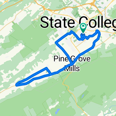
Snow Shoe Loop
A cycling route starting in State College, Pennsylvania, United States of America.
Overview
About this route
- -:--
- Duration
- 121.2 km
- Distance
- 980 m
- Ascent
- 980 m
- Descent
- ---
- Avg. speed
- ---
- Avg. speed
Route quality
Waytypes & surfaces along the route
Waytypes
Road
37.7 km
(31 %)
Track
33.5 km
(28 %)
Surfaces
Paved
48.6 km
(40 %)
Unpaved
31.8 km
(26 %)
Asphalt
48.2 km
(40 %)
Gravel
26.3 km
(22 %)
Route highlights
Points of interest along the route
Point of interest after 64.6 km
Peale Tunnel
Point of interest after 67 km
Peale
Point of interest after 71.1 km
Red Moshannon Viaduct
Continue with Bikemap
Use, edit, or download this cycling route
You would like to ride Snow Shoe Loop or customize it for your own trip? Here is what you can do with this Bikemap route:
Free features
- Save this route as favorite or in collections
- Copy & plan your own version of this route
- Sync your route with Garmin or Wahoo
Premium features
Free trial for 3 days, or one-time payment. More about Bikemap Premium.
- Navigate this route on iOS & Android
- Export a GPX / KML file of this route
- Create your custom printout (try it for free)
- Download this route for offline navigation
Discover more Premium features.
Get Bikemap PremiumFrom our community
Other popular routes starting in State College
 The Bike Paths of State College Long
- Distance
- 25.1 km
- Ascent
- 316 m
- Descent
- 316 m
- Location
- State College, Pennsylvania, United States of America
 Relaxed route in State College
- Distance
- 5.7 km
- Ascent
- 182 m
- Descent
- 141 m
- Location
- State College, Pennsylvania, United States of America
 Allegheny Front loop
- Distance
- 61.8 km
- Ascent
- 870 m
- Descent
- 872 m
- Location
- State College, Pennsylvania, United States of America
 bike route
- Distance
- 7 km
- Ascent
- 64 m
- Descent
- 67 m
- Location
- State College, Pennsylvania, United States of America
 Way Fruit Farm (30miles)
- Distance
- 51.3 km
- Ascent
- 304 m
- Descent
- 305 m
- Location
- State College, Pennsylvania, United States of America
 State College-Bellefonte
- Distance
- 20.6 km
- Ascent
- 378 m
- Descent
- 492 m
- Location
- State College, Pennsylvania, United States of America
 Purdue Mountain Loop
- Distance
- 48.2 km
- Ascent
- 509 m
- Descent
- 509 m
- Location
- State College, Pennsylvania, United States of America
 Scenic Town/Farm route and Baileyville
- Distance
- 45.7 km
- Ascent
- 222 m
- Descent
- 222 m
- Location
- State College, Pennsylvania, United States of America
Open it in the app