

Trails Gran Fondo 100km Route
A cycling route starting in Toronto, Ontario, Canada.
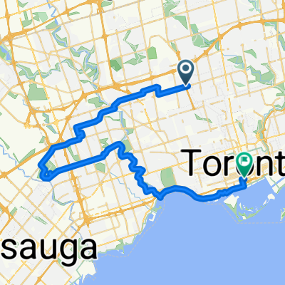
Overview
About this route
Slightly over 100km route for the trails ride. This ride follows the same route until Ravenshoe when the course turns left to head towards Trails.
- -:--
- Duration
- 96.1 km
- Distance
- 392 m
- Ascent
- 256 m
- Descent
- ---
- Avg. speed
- ---
- Avg. speed

Route quality
Waytypes & surfaces along the route
Waytypes
Busy road
51.6 km
(54 %)
Road
22.6 km
(24 %)
Surfaces
Paved
92.1 km
(96 %)
Asphalt
79.9 km
(83 %)
Paved (undefined)
11 km
(11 %)
Route highlights
Points of interest along the route
Point of interest after 51.1 km
AID STATION #1 - Look for the support cars. Stouffville Country Farmers Market will be open the day of the ride.
Point of interest after 78.2 km
Turn left for the last of the 100km route, turn right for the longer route.
Point of interest after 79.1 km
Aid station #2 - Look for the support vehicles on the side of the road. Last stop before Trails!
Continue with Bikemap
Use, edit, or download this cycling route
You would like to ride Trails Gran Fondo 100km Route or customize it for your own trip? Here is what you can do with this Bikemap route:
Free features
- Save this route as favorite or in collections
- Copy & plan your own version of this route
- Sync your route with Garmin or Wahoo
Premium features
Free trial for 3 days, or one-time payment. More about Bikemap Premium.
- Navigate this route on iOS & Android
- Export a GPX / KML file of this route
- Create your custom printout (try it for free)
- Download this route for offline navigation
Discover more Premium features.
Get Bikemap PremiumFrom our community
Other popular routes starting in Toronto
 Lawrence West to Union Station Via Centennial Park, Duck Pond, Humber River Trail,
- Distance
- 45.5 km
- Ascent
- 285 m
- Descent
- 384 m
- Location
- Toronto, Ontario, Canada
 Thicc bike bois
- Distance
- 61.3 km
- Ascent
- 173 m
- Descent
- 170 m
- Location
- Toronto, Ontario, Canada
 -Short Steep climbs & fast descents in the Beach
- Distance
- 5.2 km
- Ascent
- 98 m
- Descent
- 108 m
- Location
- Toronto, Ontario, Canada
 Cabana
- Distance
- 13.1 km
- Ascent
- 91 m
- Descent
- 93 m
- Location
- Toronto, Ontario, Canada
 Eglinton West to Union Station Via Riverdale Farm and Tommy Thompson Park
- Distance
- 33.2 km
- Ascent
- 98 m
- Descent
- 184 m
- Location
- Toronto, Ontario, Canada
 From East York to Niagara Falls
- Distance
- 155.1 km
- Ascent
- 627 m
- Descent
- 576 m
- Location
- Toronto, Ontario, Canada
 Cedarvale Park
- Distance
- 5.9 km
- Ascent
- 39 m
- Descent
- 39 m
- Location
- Toronto, Ontario, Canada
 - Short steep climbs & fast descents in the Beach
- Distance
- 5.4 km
- Ascent
- 107 m
- Descent
- 110 m
- Location
- Toronto, Ontario, Canada
Open it in the app