

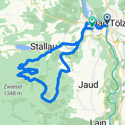
Tölz - München entlang der Isar
A cycling route starting in Bad Tölz, Bavaria, Germany.
Overview
About this route
Ende ist natürlich der Biergarten am chinesischen Turm.
Route an der Isar ab Grünwald schwer einzutragen, aber es gibt einen und zwar vor der Brücke links weg.
- -:--
- Duration
- 54.5 km
- Distance
- 239 m
- Ascent
- 384 m
- Descent
- ---
- Avg. speed
- ---
- Avg. speed

Route quality
Waytypes & surfaces along the route
Waytypes
Quiet road
20.3 km
(37 %)
Path
14.7 km
(27 %)
Surfaces
Paved
32.4 km
(60 %)
Unpaved
20.5 km
(38 %)
Asphalt
32.4 km
(60 %)
Gravel
9.1 km
(17 %)
Continue with Bikemap
Use, edit, or download this cycling route
You would like to ride Tölz - München entlang der Isar or customize it for your own trip? Here is what you can do with this Bikemap route:
Free features
- Save this route as favorite or in collections
- Copy & plan your own version of this route
- Sync your route with Garmin or Wahoo
Premium features
Free trial for 3 days, or one-time payment. More about Bikemap Premium.
- Navigate this route on iOS & Android
- Export a GPX / KML file of this route
- Create your custom printout (try it for free)
- Download this route for offline navigation
Discover more Premium features.
Get Bikemap PremiumFrom our community
Other popular routes starting in Bad Tölz
 Blomberg
- Distance
- 27.1 km
- Ascent
- 748 m
- Descent
- 709 m
- Location
- Bad Tölz, Bavaria, Germany
 Runde um Brauneck/Benediktenwand
- Distance
- 75.4 km
- Ascent
- 1,416 m
- Descent
- 1,416 m
- Location
- Bad Tölz, Bavaria, Germany
 Bad Tölz - Taufkirchen
- Distance
- 53.3 km
- Ascent
- 1,107 m
- Descent
- 1,190 m
- Location
- Bad Tölz, Bavaria, Germany
 Eichmühlstraße, Bad Tölz nach Lengries über Felder, Wiesen und Bauernhöfe zurück
- Distance
- 38.4 km
- Ascent
- 690 m
- Descent
- 696 m
- Location
- Bad Tölz, Bavaria, Germany
 Blomberg
- Distance
- 18.2 km
- Ascent
- 626 m
- Descent
- 614 m
- Location
- Bad Tölz, Bavaria, Germany
 Tölz-Kochel-Einsiedln-Jachenau-Lenggries-Tölz
- Distance
- 80.7 km
- Ascent
- 1,202 m
- Descent
- 1,153 m
- Location
- Bad Tölz, Bavaria, Germany
 München - Walchensee - München
- Distance
- 101.2 km
- Ascent
- 1,142 m
- Descent
- 1,081 m
- Location
- Bad Tölz, Bavaria, Germany
 Kleine Tölzer Kirchsee-Runde
- Distance
- 23.1 km
- Ascent
- 137 m
- Descent
- 137 m
- Location
- Bad Tölz, Bavaria, Germany
Open it in the app