

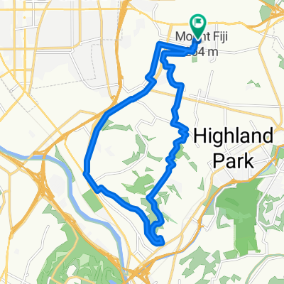
Arroyo Seco/Highland Park Loop
A cycling route starting in Glendale, California, United States of America.
Overview
About this route
- -:--
- Duration
- 18.5 km
- Distance
- 343 m
- Ascent
- 259 m
- Descent
- ---
- Avg. speed
- ---
- Avg. speed
Route quality
Waytypes & surfaces along the route
Waytypes
Road
7.1 km
(39 %)
Quiet road
6.5 km
(35 %)
Surfaces
Paved
5.8 km
(31 %)
Asphalt
5.8 km
(31 %)
Concrete
0 km
(<1 %)
Undefined
12.7 km
(69 %)
Continue with Bikemap
Use, edit, or download this cycling route
You would like to ride Arroyo Seco/Highland Park Loop or customize it for your own trip? Here is what you can do with this Bikemap route:
Free features
- Save this route as favorite or in collections
- Copy & plan your own version of this route
- Sync your route with Garmin or Wahoo
Premium features
Free trial for 3 days, or one-time payment. More about Bikemap Premium.
- Navigate this route on iOS & Android
- Export a GPX / KML file of this route
- Create your custom printout (try it for free)
- Download this route for offline navigation
Discover more Premium features.
Get Bikemap PremiumFrom our community
Other popular routes starting in Glendale
 Eagle rock - rose bowl - Glendale
- Distance
- 21 km
- Ascent
- 593 m
- Descent
- 578 m
- Location
- Glendale, California, United States of America
 Mt. Washington Loop (Clockwise)
- Distance
- 16.5 km
- Ascent
- 197 m
- Descent
- 200 m
- Location
- Glendale, California, United States of America
 Las Feliz/Atwater/Glendale -LA River Bike Path-To LONG BEACH -PCH
- Distance
- 85.8 km
- Ascent
- 336 m
- Descent
- 405 m
- Location
- Glendale, California, United States of America
 La Tuna Loop
- Distance
- 51.9 km
- Ascent
- 611 m
- Descent
- 495 m
- Location
- Glendale, California, United States of America
 Route to 4305 Griffith Park Drive, Los Angeles, CA 90027
- Distance
- 13.9 km
- Ascent
- 339 m
- Descent
- 341 m
- Location
- Glendale, California, United States of America
 420 W Elk Ave, Glendale to 32132 Castaic Lake Dr, Castaic
- Distance
- 66.3 km
- Ascent
- 660 m
- Descent
- 350 m
- Location
- Glendale, California, United States of America
 Route to 1370 North Saint Andrews Place, Los Angeles, CA 90028
- Distance
- 11.7 km
- Ascent
- 104 m
- Descent
- 160 m
- Location
- Glendale, California, United States of America
 Griffith Park Hollywood sign loop
- Distance
- 30.9 km
- Ascent
- 687 m
- Descent
- 678 m
- Location
- Glendale, California, United States of America
Open it in the app