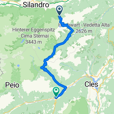
<span style="font-family: Univers; color: black; font-size: 10pt; font-weight: normal; language: de; mso-ascii-font-family: Univers; mso-fareast-font-family: +mn-ea; mso-bidi-font-family: +mn-cs; mso-color-index: 1; mso-font-kerning: 12.0pt;">Diese Tour<span style="mso-spacerun: yes;"> </span>ist<span style="mso-spacerun: yes;"> </span>sehr strapaziös, belohnt aber mit herrlichen Ausblicken interessanten Almen und </span><span style="font-family: Univers; color: black; font-size: 10pt; font-weight: normal; language: de; mso-ascii-font-family: Univers; mso-fareast-font-family: +mn-ea; mso-bidi-font-family: +mn-cs; mso-color-index: 1; mso-font-kerning: 12.0pt;">Trailabfahrten</span><span style="font-family: Univers; color: black; font-size: 10pt; font-weight: normal; language: de; mso-ascii-font-family: Univers; mso-fareast-font-family: +mn-ea; mso-bidi-font-family: +mn-cs; mso-color-index: 1; mso-font-kerning: 12.0pt;"> die die Bremsen glühen lassen.</span>
<span style="font-family: Univers; color: black; font-size: 10pt; font-weight: normal; language: de; mso-ascii-font-family: Univers; mso-fareast-font-family: +mn-ea; mso-bidi-font-family: +mn-cs; mso-color-index: 1; mso-font-kerning: 12.0pt;">Von </span><span style="font-family: Univers; color: black; font-size: 10pt; font-weight: normal; language: de; mso-ascii-font-family: Univers; mso-fareast-font-family: +mn-ea; mso-bidi-font-family: +mn-cs; mso-color-index: 1; mso-font-kerning: 12.0pt;">Morter</span><span style="font-family: Univers; color: black; font-size: 10pt; font-weight: normal; language: de; mso-ascii-font-family: Univers; mso-fareast-font-family: +mn-ea; mso-bidi-font-family: +mn-cs; mso-color-index: 1; mso-font-kerning: 12.0pt;"> aus folgen wir kurz der Via Claudia, vorbei am Eisstadion über den Trimmpfad nach </span><span style="font-family: Univers; color: black; font-size: 10pt; font-weight: normal; language: de; mso-ascii-font-family: Univers; mso-fareast-font-family: +mn-ea; mso-bidi-font-family: +mn-cs; mso-color-index: 1; mso-font-kerning: 12.0pt;">Tarsch</span><span style="font-family: Univers; color: black; font-size: 10pt; font-weight: normal; language: de; mso-ascii-font-family: Univers; mso-fareast-font-family: +mn-ea; mso-bidi-font-family: +mn-cs; mso-color-index: 1; mso-font-kerning: 12.0pt;">. Hier geht die Schinderei los. Auf gutem Untergrund geht es bis zur Freiberger Mahd Alm stetig bergauf. Die längere Pause ist jetzt obligatorisch. Hier beginnt jetzt der erste anspruchsvolle </span><span style="font-family: Univers; color: black; font-size: 10pt; font-weight: normal; language: de; mso-ascii-font-family: Univers; mso-fareast-font-family: +mn-ea; mso-bidi-font-family: +mn-cs; mso-color-index: 1; mso-font-kerning: 12.0pt;">Trail</span><span style="font-family: Univers; color: black; font-size: 10pt; font-weight: normal; language: de; mso-ascii-font-family: Univers; mso-fareast-font-family: +mn-ea; mso-bidi-font-family: +mn-cs; mso-color-index: 1; mso-font-kerning: 12.0pt;"> zur Freiberger Säge. Nochmal ein kurzes Stück bergauf und schon ist die </span><span style="font-family: Univers; color: black; font-size: 10pt; font-weight: normal; language: de; mso-ascii-font-family: Univers; mso-fareast-font-family: +mn-ea; mso-bidi-font-family: +mn-cs; mso-color-index: 1; mso-font-kerning: 12.0pt;">Marzoner</span><span style="font-family: Univers; color: black; font-size: 10pt; font-weight: normal; language: de; mso-ascii-font-family: Univers; mso-fareast-font-family: +mn-ea; mso-bidi-font-family: +mn-cs; mso-color-index: 1; mso-font-kerning: 12.0pt;"> Alm erreicht. Jetzt folgen anspruchsvolle </span><span style="font-family: Univers; color: black; font-size: 10pt; font-weight: normal; language: de; mso-ascii-font-family: Univers; mso-fareast-font-family: +mn-ea; mso-bidi-font-family: +mn-cs; mso-color-index: 1; mso-font-kerning: 12.0pt;">Trails</span><span style="font-family: Univers; color: black; font-size: 10pt; font-weight: normal; language: de; mso-ascii-font-family: Univers; mso-fareast-font-family: +mn-ea; mso-bidi-font-family: +mn-cs; mso-color-index: 1; mso-font-kerning: 12.0pt;"> bis hinunter nach </span><span style="font-family: Univers; color: black; font-size: 10pt; font-weight: normal; language: de; mso-ascii-font-family: Univers; mso-fareast-font-family: +mn-ea; mso-bidi-font-family: +mn-cs; mso-color-index: 1; mso-font-kerning: 12.0pt;">Tschars</span><span style="font-family: Univers; color: black; font-size: 10pt; font-weight: normal; language: de; mso-ascii-font-family: Univers; mso-fareast-font-family: +mn-ea; mso-bidi-font-family: +mn-cs; mso-color-index: 1; mso-font-kerning: 12.0pt;">. Der Rückweg nach </span><span style="font-family: Univers; color: black; font-size: 10pt; font-weight: normal; language: de; mso-ascii-font-family: Univers; mso-fareast-font-family: +mn-ea; mso-bidi-font-family: +mn-cs; mso-color-index: 1; mso-font-kerning: 12.0pt;">Morter</span><span style="font-family: Univers; color: black; font-size: 10pt; font-weight: normal; language: de; mso-ascii-font-family: Univers; mso-fareast-font-family: +mn-ea; mso-bidi-font-family: +mn-cs; mso-color-index: 1; mso-font-kerning: 12.0pt;"> erfolgt wieder zum größten Teil auf der Via Claudia.</span>


