

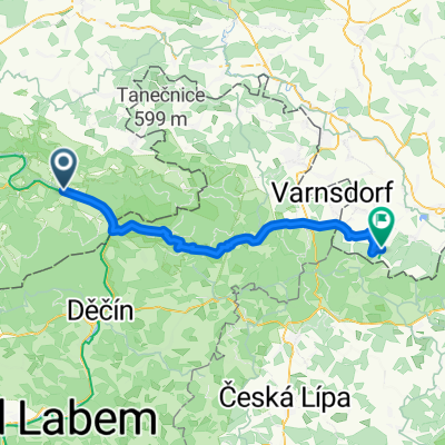
BSch_HiHeDo
A cycling route starting in Bad Schandau, Saxony, Germany.
Overview
About this route
- -:--
- Duration
- 18.6 km
- Distance
- 592 m
- Ascent
- 355 m
- Descent
- ---
- Avg. speed
- 367 m
- Avg. speed
Route quality
Waytypes & surfaces along the route
Waytypes
Busy road
14.9 km
(80 %)
Road
2 km
(11 %)
Surfaces
Paved
17.2 km
(92 %)
Unpaved
0.1 km
(<1 %)
Asphalt
17.2 km
(92 %)
Loose gravel
0.1 km
(<1 %)
Undefined
1.4 km
(8 %)
Continue with Bikemap
Use, edit, or download this cycling route
You would like to ride BSch_HiHeDo or customize it for your own trip? Here is what you can do with this Bikemap route:
Free features
- Save this route as favorite or in collections
- Copy & plan your own version of this route
- Sync your route with Garmin or Wahoo
Premium features
Free trial for 3 days, or one-time payment. More about Bikemap Premium.
- Navigate this route on iOS & Android
- Export a GPX / KML file of this route
- Create your custom printout (try it for free)
- Download this route for offline navigation
Discover more Premium features.
Get Bikemap PremiumFrom our community
Other popular routes starting in Bad Schandau
 Bad Schandau - Johnsdorf
- Distance
- 52.6 km
- Ascent
- 945 m
- Descent
- 657 m
- Location
- Bad Schandau, Saxony, Germany
 Bad Schandau, Bad Schandau to Friedrichstadt, Dresden
- Distance
- 48.2 km
- Ascent
- 389 m
- Descent
- 394 m
- Location
- Bad Schandau, Saxony, Germany
 Grosse Elbsandsteinrunde
- Distance
- 116.7 km
- Ascent
- 1,443 m
- Descent
- 1,397 m
- Location
- Bad Schandau, Saxony, Germany
 Elberadweg
- Distance
- 763.1 km
- Ascent
- 150 m
- Descent
- 287 m
- Location
- Bad Schandau, Saxony, Germany
 Bad Schandau nach Dresden
- Distance
- 44.7 km
- Ascent
- 235 m
- Descent
- 337 m
- Location
- Bad Schandau, Saxony, Germany
 Elberadweg
- Distance
- 773.3 km
- Ascent
- 237 m
- Descent
- 394 m
- Location
- Bad Schandau, Saxony, Germany
 GT2-13 Schmilka-Zittau
- Distance
- 95.7 km
- Ascent
- 1,263 m
- Descent
- 1,091 m
- Location
- Bad Schandau, Saxony, Germany
 Elbet
Elbet- Distance
- 60.2 km
- Ascent
- 923 m
- Descent
- 932 m
- Location
- Bad Schandau, Saxony, Germany
Open it in the app