
Trasa/Route 37 | mtbliptov.bike
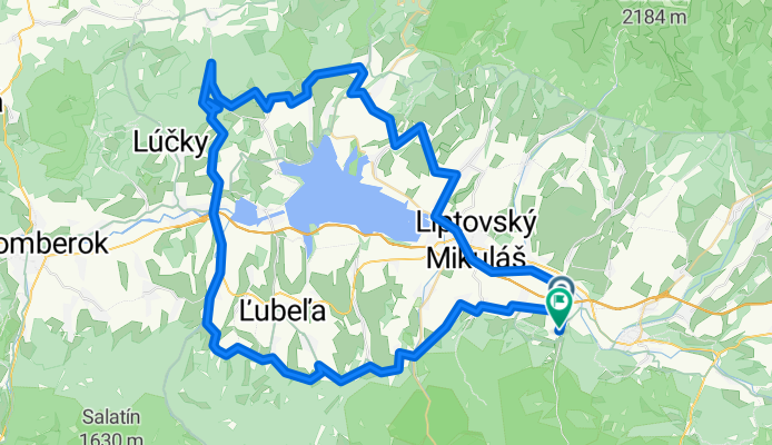
A cycling route starting in Liptovský Hrádok, Žilinský kraj, Slovak Republic.
Overview
About this route
Liptovský Ján, Liptovský Mikulás, Liptovský Ondrašová, Pavlova Ves, Liptovské Behárovce, Liptovský Trnove, Beňušovce, Kvačany, Prosiek, Liptovská Anna, Liptovský Hrad, Bešeňová, Liptovský Michal, Partizánska Ľupča, Liptovské Kľačany, Dúbrava, Lazisko, Pavčina Lehota, Ploštín, Iľanovo, Závažná Poruba, Liptovský Ján
- -:--
- Duration
- 79.2 km
- Distance
- 1,184 m
- Ascent
- 1,174 m
- Descent
- ---
- Avg. speed
- ---
- Avg. speed

Route quality
Waytypes & surfaces along the route
Waytypes
Track
35.9 km
(45 %)
Road
18 km
(23 %)
Surfaces
Paved
33.9 km
(43 %)
Unpaved
27 km
(34 %)
Asphalt
32.2 km
(41 %)
Ground
9.5 km
(12 %)
Continue with Bikemap
Use, edit, or download this cycling route
You would like to ride Trasa/Route 37 | mtbliptov.bike or customize it for your own trip? Here is what you can do with this Bikemap route:
Free features
- Save this route as favorite or in collections
- Copy & plan your own version of this route
- Sync your route with Garmin or Wahoo
Premium features
Free trial for 3 days, or one-time payment. More about Bikemap Premium.
- Navigate this route on iOS & Android
- Export a GPX / KML file of this route
- Create your custom printout (try it for free)
- Download this route for offline navigation
Discover more Premium features.
Get Bikemap PremiumFrom our community
Other popular routes starting in Liptovský Hrádok
 Liptovský Ján Svidovske sedlo a spat
- Distance
- 20 km
- Ascent
- 458 m
- Descent
- 506 m
- Location
- Liptovský Hrádok, Žilinský kraj, Slovak Republic
 Stefanikova Chata pod Dumbierom 1740mnm
- Distance
- 37.1 km
- Ascent
- 1,281 m
- Descent
- 1,281 m
- Location
- Liptovský Hrádok, Žilinský kraj, Slovak Republic
 Liptovský Ján - Svidovské sedlo - Čierny váh horná nádrž
- Distance
- 66.1 km
- Ascent
- 1,017 m
- Descent
- 1,018 m
- Location
- Liptovský Hrádok, Žilinský kraj, Slovak Republic
 Cierny vah
- Distance
- 67 km
- Ascent
- 933 m
- Descent
- 934 m
- Location
- Liptovský Hrádok, Žilinský kraj, Slovak Republic
 Trasa I
- Distance
- 43.1 km
- Ascent
- 1,044 m
- Descent
- 1,047 m
- Location
- Liptovský Hrádok, Žilinský kraj, Slovak Republic
 Liptovsky Jan Nadrz Vah
- Distance
- 24.1 km
- Ascent
- 640 m
- Descent
- 116 m
- Location
- Liptovský Hrádok, Žilinský kraj, Slovak Republic
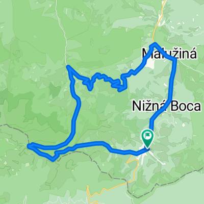
 Liptovský Ján-horáren-Maluzina a spat
- Distance
- 36.1 km
- Ascent
- 578 m
- Descent
- 578 m
- Location
- Liptovský Hrádok, Žilinský kraj, Slovak Republic
 Liptovský Hrádok - Kráľova hoľa
- Distance
- 195.5 km
- Ascent
- 3,389 m
- Descent
- 2,109 m
- Location
- Liptovský Hrádok, Žilinský kraj, Slovak Republic
Open it in the app