

erst Power dann Trail
A cycling route starting in Rödelsee, Bavaria, Germany.
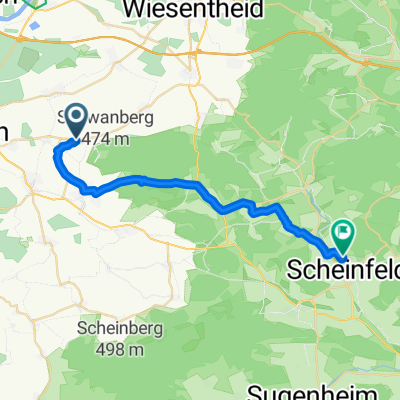
Overview
About this route
- -:--
- Duration
- 20.3 km
- Distance
- 372 m
- Ascent
- 372 m
- Descent
- ---
- Avg. speed
- ---
- Avg. speed
Continue with Bikemap
Use, edit, or download this cycling route
You would like to ride erst Power dann Trail or customize it for your own trip? Here is what you can do with this Bikemap route:
Free features
- Save this route as favorite or in collections
- Copy & plan your own version of this route
- Sync your route with Garmin or Wahoo
Premium features
Free trial for 3 days, or one-time payment. More about Bikemap Premium.
- Navigate this route on iOS & Android
- Export a GPX / KML file of this route
- Create your custom printout (try it for free)
- Download this route for offline navigation
Discover more Premium features.
Get Bikemap PremiumFrom our community
Other popular routes starting in Rödelsee
 SCF Frankentour 2 Scheinfeld
- Distance
- 67.5 km
- Ascent
- 598 m
- Descent
- 598 m
- Location
- Rödelsee, Bavaria, Germany
 Kleine Schwanbergtour
- Distance
- 9.2 km
- Ascent
- 341 m
- Descent
- 341 m
- Location
- Rödelsee, Bavaria, Germany
 Reupelsdorf - Rödelsee
- Distance
- 12.2 km
- Ascent
- 49 m
- Descent
- 71 m
- Location
- Rödelsee, Bavaria, Germany
 TGS Tour 26.09.21
- Distance
- 158.9 km
- Ascent
- 788 m
- Descent
- 917 m
- Location
- Rödelsee, Bavaria, Germany
 Wanderweg: Naturpark Steigerwald, Blaues Dreieck (Rödelsee-Weingartsgreuth)
- Distance
- 43.6 km
- Ascent
- 633 m
- Descent
- 571 m
- Location
- Rödelsee, Bavaria, Germany
 Roedelsee_Iphofen_Mainbernheim
- Distance
- 39.3 km
- Ascent
- 358 m
- Descent
- 358 m
- Location
- Rödelsee, Bavaria, Germany
 Relaxed route in Scheinfeld
- Distance
- 22.6 km
- Ascent
- 250 m
- Descent
- 206 m
- Location
- Rödelsee, Bavaria, Germany
 Schwanberg_Wanderung
- Distance
- 8.5 km
- Ascent
- 266 m
- Descent
- 266 m
- Location
- Rödelsee, Bavaria, Germany
Open it in the app