

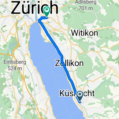
Oberer Zürichsee ab Erlenbach
A cycling route starting in Küsnacht / Heslibach, Canton of Zurich, Switzerland.
Overview
About this route
Erlenbach - Rapperswil - Horgen - Autofähre Meilen Erlenbach
- -:--
- Duration
- 54.3 km
- Distance
- 143 m
- Ascent
- 143 m
- Descent
- ---
- Avg. speed
- ---
- Avg. speed

Route quality
Waytypes & surfaces along the route
Waytypes
Quiet road
21 km
(39 %)
Busy road
16.3 km
(30 %)
Surfaces
Paved
41.8 km
(77 %)
Unpaved
6.3 km
(12 %)
Asphalt
40.3 km
(74 %)
Loose gravel
4.5 km
(8 %)
Continue with Bikemap
Use, edit, or download this cycling route
You would like to ride Oberer Zürichsee ab Erlenbach or customize it for your own trip? Here is what you can do with this Bikemap route:
Free features
- Save this route as favorite or in collections
- Copy & plan your own version of this route
- Sync your route with Garmin or Wahoo
Premium features
Free trial for 3 days, or one-time payment. More about Bikemap Premium.
- Navigate this route on iOS & Android
- Export a GPX / KML file of this route
- Create your custom printout (try it for free)
- Download this route for offline navigation
Discover more Premium features.
Get Bikemap PremiumFrom our community
Other popular routes starting in Küsnacht / Heslibach
 Küsnacht Ricken Starkenbach Amden
- Distance
- 147.8 km
- Ascent
- 1,819 m
- Descent
- 1,905 m
- Location
- Küsnacht / Heslibach, Canton of Zurich, Switzerland
 Spred Out Samstag Ride In Küsnacht Zh
- Distance
- 14 km
- Ascent
- 87 m
- Descent
- 92 m
- Location
- Küsnacht / Heslibach, Canton of Zurich, Switzerland
 Obere Heslibachstrasse 72, Küsnacht ZH nach Bauen
- Distance
- 73.8 km
- Ascent
- 1,283 m
- Descent
- 1,277 m
- Location
- Küsnacht / Heslibach, Canton of Zurich, Switzerland
 Erlenweg 6, Küsnacht ZH nach Stegstrasse 23, Egg
- Distance
- 2,422 km
- Ascent
- 2,018 m
- Descent
- 1,914 m
- Location
- Küsnacht / Heslibach, Canton of Zurich, Switzerland
 Erlenbach-Sternenberg-Erlenbach
- Distance
- 75 km
- Ascent
- 1,163 m
- Descent
- 1,162 m
- Location
- Küsnacht / Heslibach, Canton of Zurich, Switzerland
 Küsnacht-Sattelegg-Greifensee-Küsnacht
- Distance
- 140.1 km
- Ascent
- 1,231 m
- Descent
- 1,231 m
- Location
- Küsnacht / Heslibach, Canton of Zurich, Switzerland
 Küsnachter Tobel - Forch - Egg - Feldbach - Goldküste
- Distance
- 42.8 km
- Ascent
- 391 m
- Descent
- 391 m
- Location
- Küsnacht / Heslibach, Canton of Zurich, Switzerland
 Relaxed route in Zürich
- Distance
- 8.2 km
- Ascent
- 45 m
- Descent
- 32 m
- Location
- Küsnacht / Heslibach, Canton of Zurich, Switzerland
Open it in the app