

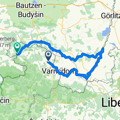
K pramenům Mandavy
A cycling route starting in Rumburk, Ústecký kraj, Czechia.
Overview
About this route
Lesem tam, po silnici nazpět
- -:--
- Duration
- 23.7 km
- Distance
- 258 m
- Ascent
- 265 m
- Descent
- ---
- Avg. speed
- ---
- Avg. speed

Route quality
Waytypes & surfaces along the route
Waytypes
Road
8.5 km
(36 %)
Busy road
6.1 km
(26 %)
Surfaces
Paved
10.8 km
(46 %)
Unpaved
3.3 km
(14 %)
Asphalt
10.5 km
(45 %)
Gravel
2.8 km
(12 %)
Continue with Bikemap
Use, edit, or download this cycling route
You would like to ride K pramenům Mandavy or customize it for your own trip? Here is what you can do with this Bikemap route:
Free features
- Save this route as favorite or in collections
- Copy & plan your own version of this route
- Sync your route with Garmin or Wahoo
Premium features
Free trial for 3 days, or one-time payment. More about Bikemap Premium.
- Navigate this route on iOS & Android
- Export a GPX / KML file of this route
- Create your custom printout (try it for free)
- Download this route for offline navigation
Discover more Premium features.
Get Bikemap PremiumFrom our community
Other popular routes starting in Rumburk
 Hainewalde
- Distance
- 45.3 km
- Ascent
- 933 m
- Descent
- 930 m
- Location
- Rumburk, Ústecký kraj, Czechia
 Pod Jitrovníkem a Valdecká stezka
- Distance
- 28.3 km
- Ascent
- 257 m
- Descent
- 257 m
- Location
- Rumburk, Ústecký kraj, Czechia
 Do Petrovic
- Distance
- 31.9 km
- Ascent
- 354 m
- Descent
- 253 m
- Location
- Rumburk, Ústecký kraj, Czechia
 únorová
- Distance
- 40.1 km
- Ascent
- 376 m
- Descent
- 370 m
- Location
- Rumburk, Ústecký kraj, Czechia
 Tour de Zeleńák
- Distance
- 53.5 km
- Ascent
- 623 m
- Descent
- 622 m
- Location
- Rumburk, Ústecký kraj, Czechia
 Rumburk-Krásná Lípa-Chřibská-Česká Kamenice-Mlýny-Kytlice-Dolní Podluží-Varnsdorf-Seifhennersdorf-Rumburk
- Distance
- 61.4 km
- Ascent
- 662 m
- Descent
- 662 m
- Location
- Rumburk, Ústecký kraj, Czechia
 Mandava-Nisa-Spréva
- Distance
- 116.7 km
- Ascent
- 594 m
- Descent
- 637 m
- Location
- Rumburk, Ústecký kraj, Czechia
 Lipová-Sohland-bloudění u Fukova-Spremberg-Jiříkov-Rbk
- Distance
- 49.5 km
- Ascent
- 954 m
- Descent
- 950 m
- Location
- Rumburk, Ústecký kraj, Czechia
Open it in the app