
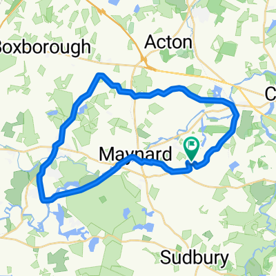
Maynard - Chelmsford Loop
A cycling route starting in Maynard, Massachusetts, United States of America.
Overview
About this route
Mostly bike path
- -:--
- Duration
- 52.9 km
- Distance
- 142 m
- Ascent
- 142 m
- Descent
- ---
- Avg. speed
- ---
- Avg. speed

Route quality
Waytypes & surfaces along the route
Waytypes
Cycleway
32 km
(61 %)
Road
12.6 km
(24 %)
Surfaces
Paved
39.4 km
(74 %)
Asphalt
38.8 km
(73 %)
Paved (undefined)
0.3 km
(<1 %)
Continue with Bikemap
Use, edit, or download this cycling route
You would like to ride Maynard - Chelmsford Loop or customize it for your own trip? Here is what you can do with this Bikemap route:
Free features
- Save this route as favorite or in collections
- Copy & plan your own version of this route
- Sync your route with Garmin or Wahoo
Premium features
Free trial for 3 days, or one-time payment. More about Bikemap Premium.
- Navigate this route on iOS & Android
- Export a GPX / KML file of this route
- Create your custom printout (try it for free)
- Download this route for offline navigation
Discover more Premium features.
Get Bikemap PremiumFrom our community
Other popular routes starting in Maynard
 1st Short bike tour through Stow
- Distance
- 9.1 km
- Ascent
- 52 m
- Descent
- 51 m
- Location
- Maynard, Massachusetts, United States of America
 Maynard - Chelmsford Loop
- Distance
- 52.9 km
- Ascent
- 142 m
- Descent
- 142 m
- Location
- Maynard, Massachusetts, United States of America
 Rte 27, Concord Rd, Concord
- Distance
- 34.7 km
- Ascent
- 162 m
- Descent
- 162 m
- Location
- Maynard, Massachusetts, United States of America
 Assabet 30 mile
- Distance
- 15.2 km
- Ascent
- 90 m
- Descent
- 69 m
- Location
- Maynard, Massachusetts, United States of America
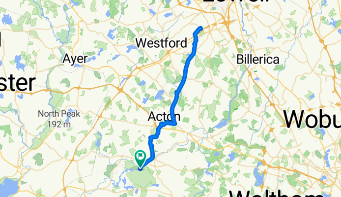
 Maynard Bike Path, Stow, Acton, Concord
- Distance
- 31.5 km
- Ascent
- 155 m
- Descent
- 154 m
- Location
- Maynard, Massachusetts, United States of America
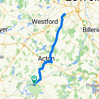
 Honey Pot, Acton, W Concord
- Distance
- 30 km
- Ascent
- 156 m
- Descent
- 156 m
- Location
- Maynard, Massachusetts, United States of America
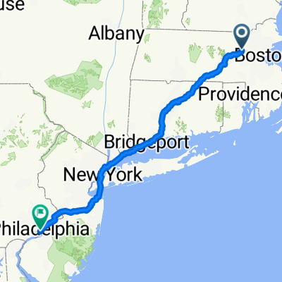 9 Country Club Rd, Acton to 16–100 S Independence Mall W, Philadelphia
- Distance
- 531.5 km
- Ascent
- 3,092 m
- Descent
- 3,141 m
- Location
- Maynard, Massachusetts, United States of America
 Acton-SawyerHill-Acton-SHORT
- Distance
- 56.3 km
- Ascent
- 306 m
- Descent
- 305 m
- Location
- Maynard, Massachusetts, United States of America
Open it in the app