

Panoramaweg Spitzer Graben
A cycling route starting in Spitz, Lower Austria, Austria.
Overview
About this route
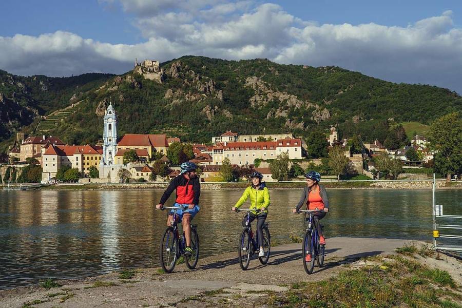
Durch das imposante Wachauer Seitental Spitzer Graben führt uns die Höhenrundwanderung von Spitz nach Mühldorf. Steile Steinterrassen, alte Eichen-/Buchenwälder, Winzerdörfer, die roman(t)ische Burg Oberranna und weite Ausblicke in den Spitzer Graben, auf die Donau und in den Naturpark Jauerling erwarten uns.
- 3 h 28 min
- Duration
- 19.7 km
- Distance
- 780 m
- Ascent
- 782 m
- Descent
- 5.7 km/h
- Avg. speed
- ---
- Avg. speed
Continue with Bikemap
Use, edit, or download this cycling route
You would like to ride Panoramaweg Spitzer Graben or customize it for your own trip? Here is what you can do with this Bikemap route:
Free features
- Save this route as favorite or in collections
- Copy & plan your own version of this route
- Sync your route with Garmin or Wahoo
Premium features
Free trial for 3 days, or one-time payment. More about Bikemap Premium.
- Navigate this route on iOS & Android
- Export a GPX / KML file of this route
- Create your custom printout (try it for free)
- Download this route for offline navigation
Discover more Premium features.
Get Bikemap PremiumFrom our community
Other popular routes starting in Spitz
 Um den Jauerling
- Distance
- 49.6 km
- Ascent
- 347 m
- Descent
- 345 m
- Location
- Spitz, Lower Austria, Austria
 Spitz - Jauerling
- Distance
- 10.2 km
- Ascent
- 786 m
- Descent
- 30 m
- Location
- Spitz, Lower Austria, Austria
 Spitz-Linz
- Distance
- 121.9 km
- Ascent
- 241 m
- Descent
- 191 m
- Location
- Spitz, Lower Austria, Austria
 Spitz - Weinsteintour
- Distance
- 47 km
- Ascent
- 1,610 m
- Descent
- 1,609 m
- Location
- Spitz, Lower Austria, Austria
 WACHAU Route
- Distance
- 38.6 km
- Ascent
- 393 m
- Descent
- 394 m
- Location
- Spitz, Lower Austria, Austria
 Wachau túra második nap
- Distance
- 19.2 km
- Ascent
- 62 m
- Descent
- 100 m
- Location
- Spitz, Lower Austria, Austria
 14.06.2017 RK Spitz-Schönbühel-Melk-Ybbs-Emmersdorf-Aggsbach Markt
- Distance
- 97.2 km
- Ascent
- 157 m
- Descent
- 156 m
- Location
- Spitz, Lower Austria, Austria
 Spitz, Kremstal
- Distance
- 60 km
- Ascent
- 599 m
- Descent
- 597 m
- Location
- Spitz, Lower Austria, Austria
Open it in the app