

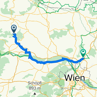
2020-06-11 2:48 Graslweg
A cycling route starting in Gars am Kamp, Lower Austria, Austria.
Overview
About this route
- 2 h 49 min
- Duration
- 45.2 km
- Distance
- 607 m
- Ascent
- 618 m
- Descent
- 16.1 km/h
- Avg. speed
- ---
- Avg. speed

Continue with Bikemap
Use, edit, or download this cycling route
You would like to ride 2020-06-11 2:48 Graslweg or customize it for your own trip? Here is what you can do with this Bikemap route:
Free features
- Save this route as favorite or in collections
- Copy & plan your own version of this route
- Sync your route with Garmin or Wahoo
Premium features
Free trial for 3 days, or one-time payment. More about Bikemap Premium.
- Navigate this route on iOS & Android
- Export a GPX / KML file of this route
- Create your custom printout (try it for free)
- Download this route for offline navigation
Discover more Premium features.
Get Bikemap PremiumFrom our community
Other popular routes starting in Gars am Kamp
 Gars am Kamp-Krems
- Distance
- 33.8 km
- Ascent
- 176 m
- Descent
- 244 m
- Location
- Gars am Kamp, Lower Austria, Austria
 Gars-Rosenburg-Tautendorf-Stiefern-
- Distance
- 36.6 km
- Ascent
- 446 m
- Descent
- 446 m
- Location
- Gars am Kamp, Lower Austria, Austria
 Ausfahrt von Stallegg nach Langenlois
- Distance
- 25.7 km
- Ascent
- 167 m
- Descent
- 225 m
- Location
- Gars am Kamp, Lower Austria, Austria
 15.05.2022
- Distance
- 46.9 km
- Ascent
- 369 m
- Descent
- 371 m
- Location
- Gars am Kamp, Lower Austria, Austria
 Groll
Groll- Distance
- 50.5 km
- Ascent
- 532 m
- Descent
- 533 m
- Location
- Gars am Kamp, Lower Austria, Austria
 Stupa Irene 1
- Distance
- 90.1 km
- Ascent
- 340 m
- Descent
- 418 m
- Location
- Gars am Kamp, Lower Austria, Austria
 KTM1
KTM1- Distance
- 56 km
- Ascent
- 1,290 m
- Descent
- 1,016 m
- Location
- Gars am Kamp, Lower Austria, Austria
 kleine Kamptalrunde
- Distance
- 29.2 km
- Ascent
- 408 m
- Descent
- 409 m
- Location
- Gars am Kamp, Lower Austria, Austria
Open it in the app