

MTB-Berg: Manessen-Tschriet-Feuerberg-GerlitzenGipfel
A cycling route starting in Steindorf am Ossiacher See, Carinthia, Austria.
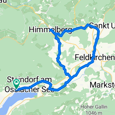
Overview
About this route
MTB-Berg: Manessen-Tschriet-Feuerberg-GerlitzenGipfel
- -:--
- Duration
- 15.1 km
- Distance
- 1,039 m
- Ascent
- 116 m
- Descent
- ---
- Avg. speed
- ---
- Avg. speed

Continue with Bikemap
Use, edit, or download this cycling route
You would like to ride MTB-Berg: Manessen-Tschriet-Feuerberg-GerlitzenGipfel or customize it for your own trip? Here is what you can do with this Bikemap route:
Free features
- Save this route as favorite or in collections
- Copy & plan your own version of this route
- Sync your route with Garmin or Wahoo
Premium features
Free trial for 3 days, or one-time payment. More about Bikemap Premium.
- Navigate this route on iOS & Android
- Export a GPX / KML file of this route
- Create your custom printout (try it for free)
- Download this route for offline navigation
Discover more Premium features.
Get Bikemap PremiumFrom our community
Other popular routes starting in Steindorf am Ossiacher See
 Ossiacher See - Gerlitzen - Ossiacher See
- Distance
- 74.5 km
- Ascent
- 1,688 m
- Descent
- 1,694 m
- Location
- Steindorf am Ossiacher See, Carinthia, Austria
 Klim Tauer 390 m / 14 km
- Distance
- 14.4 km
- Ascent
- 430 m
- Descent
- 432 m
- Location
- Steindorf am Ossiacher See, Carinthia, Austria
 klagenfurt
- Distance
- 117.7 km
- Ascent
- 532 m
- Descent
- 532 m
- Location
- Steindorf am Ossiacher See, Carinthia, Austria
 BikeComputer Training Session
- Distance
- 27 km
- Ascent
- 108 m
- Descent
- 110 m
- Location
- Steindorf am Ossiacher See, Carinthia, Austria
 Umrundung Ossiachersee
- Distance
- 29 km
- Ascent
- 100 m
- Descent
- 102 m
- Location
- Steindorf am Ossiacher See, Carinthia, Austria
 ossiacher see rundfahrt
- Distance
- 27.2 km
- Ascent
- 210 m
- Descent
- 207 m
- Location
- Steindorf am Ossiacher See, Carinthia, Austria
 Route Stiegl- Himmelberrg
- Distance
- 34.6 km
- Ascent
- 465 m
- Descent
- 466 m
- Location
- Steindorf am Ossiacher See, Carinthia, Austria
 MTB-Trail: Prefelnig-OssiacherTauern-HubyTrail-AltOssiach-Ossiach-Ostriach-ToghyTrail-TRANSFER-ParthyTrail-Ostriach-Ossiach-Prefelnig-
- Distance
- 20.4 km
- Ascent
- 662 m
- Descent
- 663 m
- Location
- Steindorf am Ossiacher See, Carinthia, Austria
Open it in the app