

Traumschleife Altlayer Schweiz
A cycling route starting in Altlay, Rhineland-Palatinate, Germany.
Overview
About this route
Der Weg durch die Altlayer Schweiz ist geprägt durch scharfkantige, schroffe Schieferfelsen, beeindruckende Felspassagen sowie serpentinenartige Waldpfade. Idyllische, scheinbar unberührte Bachtäler sowie außergewöhnliche Fernblicke sind weitere Besonderheiten einer Halbtagestour durch ausgedehnte Waldgebiete des Hunsrücks rund um Altlay. /
- 2 h 54 min
- Duration
- 8.7 km
- Distance
- 394 m
- Ascent
- 392 m
- Descent
- 3 km/h
- Avg. speed
- ---
- Avg. speed

Continue with Bikemap
Use, edit, or download this cycling route
You would like to ride Traumschleife Altlayer Schweiz or customize it for your own trip? Here is what you can do with this Bikemap route:
Free features
- Save this route as favorite or in collections
- Copy & plan your own version of this route
- Sync your route with Garmin or Wahoo
Premium features
Free trial for 3 days, or one-time payment. More about Bikemap Premium.
- Navigate this route on iOS & Android
- Export a GPX / KML file of this route
- Create your custom printout (try it for free)
- Download this route for offline navigation
Discover more Premium features.
Get Bikemap PremiumFrom our community
Other popular routes starting in Altlay
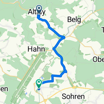 Altlay- Hahn
- Distance
- 9.3 km
- Ascent
- 206 m
- Descent
- 69 m
- Location
- Altlay, Rhineland-Palatinate, Germany
 Traumschleife Altlayer Schweiz
- Distance
- 8.7 km
- Ascent
- 394 m
- Descent
- 392 m
- Location
- Altlay, Rhineland-Palatinate, Germany
 Siedlung Briedeler Heck 8, Briedel nach Auf der Mauer 1–3, Kirchberg (Hunsrück)
- Distance
- 15 km
- Ascent
- 234 m
- Descent
- 223 m
- Location
- Altlay, Rhineland-Palatinate, Germany
 Moderate route in
- Distance
- 5.9 km
- Ascent
- 53 m
- Descent
- 285 m
- Location
- Altlay, Rhineland-Palatinate, Germany
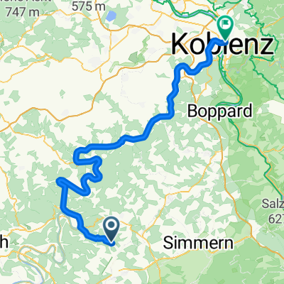 Altlay- Koblenz : Day 4 part1
- Distance
- 96.7 km
- Ascent
- 151 m
- Descent
- 432 m
- Location
- Altlay, Rhineland-Palatinate, Germany
 Steady ride in Kastellaun
- Distance
- 19.2 km
- Ascent
- 266 m
- Descent
- 186 m
- Location
- Altlay, Rhineland-Palatinate, Germany
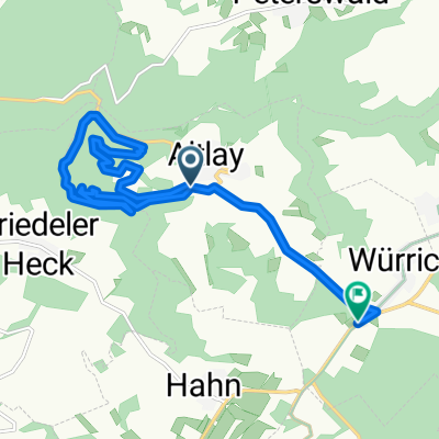 Route nach Hunsrückhöhenstraße, Würrich
- Distance
- 13.3 km
- Ascent
- 484 m
- Descent
- 375 m
- Location
- Altlay, Rhineland-Palatinate, Germany
 Recovered Route
- Distance
- 1.2 km
- Ascent
- 75 m
- Descent
- 4 m
- Location
- Altlay, Rhineland-Palatinate, Germany
Open it in the app