Premium Badge Download on the App Store Get it on Google Play Turn-by-turn Navigation Offline Maps Bike Type Optimized Routing Premium Maps Custom Bike Computer Export Routes Route Previews Fall Detection Premium Support

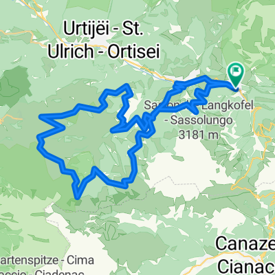
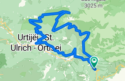
Cycling Route in Sëlva, Trentino-Alto Adige, Italy

MTB Tour Seceda Trails 2

0
Open this route in the Bikemap app

Open this route in the Bikemap app

Open this route in Bikemap Web

Open this route in Bikemap Web

42 km
Distance
2206 m
Ascent
2201 m
Descent
-:-- h
Duration
-- km/h
Avg. Speed
--- m
Max. Elevation

About This Route

Die Tour wartet mit teils steilen 1600 hm auf, von denen sich die ersten ca. 850 hm alternativ durch Benutzung der Raschötz-Standseilbahn umgehen lassen. Belohnt werden die Mühen des Aufstiegs mit genialen, flowigen Trails. Durch die nun folgende Seilbahn-Auffahrt kommen wir in den Genuss weiterer flowiger Abfahrten auf Trails und Schotterwegen hinunter über Wolkenstein nach St. Ulrich. Insbesondere der letzte Trail-Abschnitt zur Seilbahn-Mittelstation und der erste Abschnitt nach der Bergstation sind durchaus anspruchsvoll. Landschaftlich ist die Rundtour mit ihren grandiosen Ausblicken auf die Geißler-Gruppe und die Seceda-Kette kaum zu toppen. Eine sehr gute Kondition und eine gewisse Trailerfahrung sind von großem Vorteil.

This cycling route is ideal for: MTB

You will cycle on the following surfaces: Unpaved

Customize this cycling route with the Bikemap route planner.

Make it yours!

Did you know? You can use this route as a template in our cycling route planner if you don't wish to start from scratch. Customize it based on your needs to plan your perfect cycling tour.

Open it in the app