

Osterburker Land
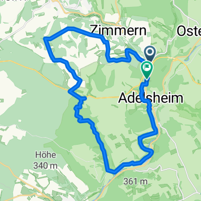
A cycling route starting in Adelsheim, Baden-Württemberg, Germany.
Overview
About this route
Tagestour in wenigen Tagen - ANfahrt mit Zug
- -:--
- Duration
- 115.4 km
- Distance
- 458 m
- Ascent
- 511 m
- Descent
- ---
- Avg. speed
- ---
- Avg. speed
Route quality
Waytypes & surfaces along the route
Waytypes
Busy road
64.8 km
(56 %)
Road
19.4 km
(17 %)
Surfaces
Paved
100.6 km
(87 %)
Unpaved
4.4 km
(4 %)
Asphalt
98.6 km
(85 %)
Gravel
3.6 km
(3 %)
Continue with Bikemap
Use, edit, or download this cycling route
You would like to ride Osterburker Land or customize it for your own trip? Here is what you can do with this Bikemap route:
Free features
- Save this route as favorite or in collections
- Copy & plan your own version of this route
- Sync your route with Garmin or Wahoo
Premium features
Free trial for 3 days, or one-time payment. More about Bikemap Premium.
- Navigate this route on iOS & Android
- Export a GPX / KML file of this route
- Create your custom printout (try it for free)
- Download this route for offline navigation
Discover more Premium features.
Get Bikemap PremiumFrom our community
Other popular routes starting in Adelsheim
 BGHM Route 2
- Distance
- 33.1 km
- Ascent
- 520 m
- Descent
- 530 m
- Location
- Adelsheim, Baden-Württemberg, Germany
 weingut weibler
- Distance
- 65.5 km
- Ascent
- 615 m
- Descent
- 607 m
- Location
- Adelsheim, Baden-Württemberg, Germany
 Schloßstraße 14, Adelsheim nach Herrenwiesenweg 14, Zaberfeld
- Distance
- 80.8 km
- Ascent
- 808 m
- Descent
- 799 m
- Location
- Adelsheim, Baden-Württemberg, Germany
 Adelsheim-Zimmern-Sennfeld
- Distance
- 21.9 km
- Ascent
- 548 m
- Descent
- 543 m
- Location
- Adelsheim, Baden-Württemberg, Germany
 Rund um Sennfeld
- Distance
- 23.1 km
- Ascent
- 235 m
- Descent
- 235 m
- Location
- Adelsheim, Baden-Württemberg, Germany
 17.06.2022
- Distance
- 54.2 km
- Ascent
- 803 m
- Descent
- 694 m
- Location
- Adelsheim, Baden-Württemberg, Germany
 Osterburker Land
- Distance
- 115.4 km
- Ascent
- 458 m
- Descent
- 511 m
- Location
- Adelsheim, Baden-Württemberg, Germany
 Sennfeld BGHM Route 1
- Distance
- 23.6 km
- Ascent
- 337 m
- Descent
- 338 m
- Location
- Adelsheim, Baden-Württemberg, Germany
Open it in the app