

Tour de Suisse 1: Konstanz-Luzern
A cycling route starting in Kreuzlingen, Thurgau, Switzerland.
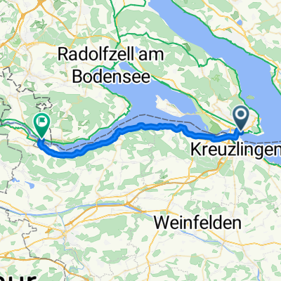
Overview
About this route
-
Tag: Frauenfeld
-
Tag: Winterthur
-
Tag: Zürich
-
Tag: Linthal
-
Tag: Seedorf
-
Tag: Vitznau
-
Tag Hergiswil
- -:--
- Duration
- 366.8 km
- Distance
- 2,222 m
- Ascent
- 2,181 m
- Descent
- ---
- Avg. speed
- ---
- Avg. speed

Route quality
Waytypes & surfaces along the route
Waytypes
Quiet road
128.3 km
(35 %)
Busy road
90.2 km
(25 %)
Surfaces
Paved
303.5 km
(83 %)
Unpaved
20.9 km
(6 %)
Asphalt
297.8 km
(81 %)
Gravel
9.3 km
(3 %)
Route highlights
Points of interest along the route
Point of interest after 10 km
Schloss salenstein
Photo after 36.1 km
Ittingen
Point of interest after 40.4 km
Andreas+Sarah
Photo after 73.8 km
Rheinau
Point of interest after 101.6 km
Véronique
Photo after 129.3 km
Katzensee
Photo after 136.8 km
Seebach
Point of interest after 145.6 km
Tanh, Hao, Tomoko
Photo after 205.2 km
Baumwipfelpfad Neckertal
Point of interest after 241.1 km
Michéle, Ruth
Point of interest after 290.2 km
Marco + Simi
Point of interest after 311.3 km
Gütschli
Point of interest after 335.1 km
Rigi
Point of interest after 348.4 km
Merlischachen
Point of interest after 351 km
Martä+Franziska
Point of interest after 358.6 km
Nicolas und Julia
Point of interest after 358.6 km
Luggli
Point of interest after 358.6 km
Bern
Point of interest after 358.6 km
Pascale Schnyder
Point of interest after 358.7 km
Niederscherli
Point of interest after 358.8 km
Vero+Christian
Continue with Bikemap
Use, edit, or download this cycling route
You would like to ride Tour de Suisse 1: Konstanz-Luzern or customize it for your own trip? Here is what you can do with this Bikemap route:
Free features
- Save this route as favorite or in collections
- Copy & plan your own version of this route
- Sync your route with Garmin or Wahoo
Premium features
Free trial for 3 days, or one-time payment. More about Bikemap Premium.
- Navigate this route on iOS & Android
- Export a GPX / KML file of this route
- Create your custom printout (try it for free)
- Download this route for offline navigation
Discover more Premium features.
Get Bikemap PremiumFrom our community
Other popular routes starting in Kreuzlingen
 Bodenseeradweg ab Friedrichshafen
- Distance
- 255.9 km
- Ascent
- 268 m
- Descent
- 268 m
- Location
- Kreuzlingen, Thurgau, Switzerland
 Abendrunde Thurgau
- Distance
- 40 km
- Ascent
- 252 m
- Descent
- 253 m
- Location
- Kreuzlingen, Thurgau, Switzerland
 Untersee
- Distance
- 70.5 km
- Ascent
- 218 m
- Descent
- 219 m
- Location
- Kreuzlingen, Thurgau, Switzerland
 Samstagmittagrunde
- Distance
- 46.3 km
- Ascent
- 288 m
- Descent
- 291 m
- Location
- Kreuzlingen, Thurgau, Switzerland
 Tour 3/34 km / Insel-Reichenau
- Distance
- 33.9 km
- Ascent
- 134 m
- Descent
- 133 m
- Location
- Kreuzlingen, Thurgau, Switzerland
 ETAPE 1 : Kreuzlingen / Uberlingen
- Distance
- 46 km
- Ascent
- 252 m
- Descent
- 258 m
- Location
- Kreuzlingen, Thurgau, Switzerland
 Rastplatztour dem Wasser nach
- Distance
- 18.4 km
- Ascent
- 26 m
- Descent
- 32 m
- Location
- Kreuzlingen, Thurgau, Switzerland
 D 251 Konstanz - Stein am Rhein
- Distance
- 29.5 km
- Ascent
- 75 m
- Descent
- 75 m
- Location
- Kreuzlingen, Thurgau, Switzerland
Open it in the app