

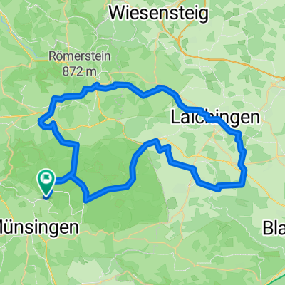
Münsingen Lichtenstein
A cycling route starting in Münsingen, Baden-Württemberg, Germany.
Overview
About this route
Diese -durchaus anspruchsvolle- Tour führt uns zum Schloss Lichtenstein und zurück über die Albhochfläche bei St.Johann und Gächingen. (Tourbeschreibung unter: thod_er@gmx.de)
- -:--
- Duration
- 56.6 km
- Distance
- 30,632 m
- Ascent
- 31,337 m
- Descent
- ---
- Avg. speed
- 842 m
- Avg. speed
Route quality
Waytypes & surfaces along the route
Waytypes
Track
27 km
(48 %)
Quiet road
14.9 km
(26 %)
Surfaces
Paved
41.4 km
(73 %)
Unpaved
10.4 km
(18 %)
Asphalt
37.7 km
(67 %)
Loose gravel
4.7 km
(8 %)
Continue with Bikemap
Use, edit, or download this cycling route
You would like to ride Münsingen Lichtenstein or customize it for your own trip? Here is what you can do with this Bikemap route:
Free features
- Save this route as favorite or in collections
- Copy & plan your own version of this route
- Sync your route with Garmin or Wahoo
Premium features
Free trial for 3 days, or one-time payment. More about Bikemap Premium.
- Navigate this route on iOS & Android
- Export a GPX / KML file of this route
- Create your custom printout (try it for free)
- Download this route for offline navigation
Discover more Premium features.
Get Bikemap PremiumFrom our community
Other popular routes starting in Münsingen
 Über die Albhöhen ins Lautertal
- Distance
- 38.4 km
- Ascent
- 665 m
- Descent
- 680 m
- Location
- Münsingen, Baden-Württemberg, Germany
 50 Samstag 2025
- Distance
- 50 km
- Ascent
- 611 m
- Descent
- 610 m
- Location
- Münsingen, Baden-Württemberg, Germany
 e-Bike Tour 3 / Gruorn und Trailfinger Schlucht
- Distance
- 41.8 km
- Ascent
- 693 m
- Descent
- 693 m
- Location
- Münsingen, Baden-Württemberg, Germany
 Buchbare Tour 4 | 4. Tag Variante 1
- Distance
- 8 km
- Ascent
- 145 m
- Descent
- 141 m
- Location
- Münsingen, Baden-Württemberg, Germany
 Buchbare Tour 4 | 3. Tag
- Distance
- 18.1 km
- Ascent
- 334 m
- Descent
- 333 m
- Location
- Münsingen, Baden-Württemberg, Germany
 Buchbare Tour 4 | 2. Tag
- Distance
- 10.8 km
- Ascent
- 196 m
- Descent
- 195 m
- Location
- Münsingen, Baden-Württemberg, Germany
 Trailfinger Säge-Laichingen
- Distance
- 59.4 km
- Ascent
- 857 m
- Descent
- 856 m
- Location
- Münsingen, Baden-Württemberg, Germany
 MÜNSINGER E-BIKE TOUR 1: Gestütshof und Rutschenfelsen
- Distance
- 45.2 km
- Ascent
- 657 m
- Descent
- 660 m
- Location
- Münsingen, Baden-Württemberg, Germany
Open it in the app