

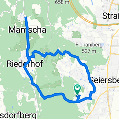
R12_Buchkogel_RUN
A cycling route starting in Pirka, Styria, Austria.
Overview
About this route
- -:--
- Duration
- 15.2 km
- Distance
- 397 m
- Ascent
- 397 m
- Descent
- ---
- Avg. speed
- ---
- Avg. speed
Route quality
Waytypes & surfaces along the route
Waytypes
Track
7.6 km
(50 %)
Quiet road
3.9 km
(26 %)
Surfaces
Paved
2.1 km
(14 %)
Unpaved
9.9 km
(65 %)
Ground
5.7 km
(37 %)
Gravel
2.1 km
(14 %)
Continue with Bikemap
Use, edit, or download this cycling route
You would like to ride R12_Buchkogel_RUN or customize it for your own trip? Here is what you can do with this Bikemap route:
Free features
- Save this route as favorite or in collections
- Copy & plan your own version of this route
- Sync your route with Garmin or Wahoo
Premium features
Free trial for 3 days, or one-time payment. More about Bikemap Premium.
- Navigate this route on iOS & Android
- Export a GPX / KML file of this route
- Create your custom printout (try it for free)
- Download this route for offline navigation
Discover more Premium features.
Get Bikemap PremiumFrom our community
Other popular routes starting in Pirka
 Berghofstraße 13, Seiersberg nach Amselgasse 1, Pirka
- Distance
- 9.7 km
- Ascent
- 268 m
- Descent
- 305 m
- Location
- Pirka, Styria, Austria
 Riederhof 32, Riederhof nach Riederhof 74, Riederhof
- Distance
- 18.9 km
- Ascent
- 416 m
- Descent
- 426 m
- Location
- Pirka, Styria, Austria
 Höhenweg 35, Seiersberg nach Steinberg 6, Thal
- Distance
- 12 km
- Ascent
- 249 m
- Descent
- 169 m
- Location
- Pirka, Styria, Austria
 R12_Buchkogel_RUN
- Distance
- 15.2 km
- Ascent
- 397 m
- Descent
- 397 m
- Location
- Pirka, Styria, Austria
 Plankenwarther Runde
- Distance
- 44.2 km
- Ascent
- 603 m
- Descent
- 601 m
- Location
- Pirka, Styria, Austria
 Florianibergstraße, Graz nach Mantscha 14, Mantscha
- Distance
- 3.5 km
- Ascent
- 80 m
- Descent
- 141 m
- Location
- Pirka, Styria, Austria
 Packer Straße 11–19, Unterpremstätten-Zettling to Waldgasse 1, Spatenhof
- Distance
- 2 km
- Ascent
- 31 m
- Descent
- 66 m
- Location
- Pirka, Styria, Austria
 Hummelbergweg 2A, Seiersberg-Pirka nach Hummelbergweg 2A, Seiersberg-Pirka
- Distance
- 12.9 km
- Ascent
- 326 m
- Descent
- 337 m
- Location
- Pirka, Styria, Austria