Premium Badge Download on the App Store Get it on Google Play Turn-by-turn Navigation Offline Maps Bike Type Optimized Routing Premium Maps Custom Bike Computer Export Routes Route Previews Fall Detection Premium Support

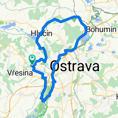
Cycling Route in Hlučín, Moravskoslezský kraj, Czechia

Dol. Benešov - Hrabyň - Jakubčovice (rozhledna) - Raduň - Dol. Benešov

1
Open this route in the Bikemap app

Open this route in the Bikemap app

Open this route in Bikemap Web

Open this route in Bikemap Web

48 km
Distance
401 m
Ascent
395 m
Descent
-:-- h
Duration
-- km/h
Avg. Speed
--- m
Max. Elevation

About This Route

Trasa je převážně kopcovitá, jen posledních 14 km se táhne Poopavskou nížinou. Trasa nabízí krásný výhled na panorama Beskyd, Oderských vrchů i Jeseníků (ty je vidět z rozhledny v Jakubčovicích). Povrch je převážně zpevněný.

This cycling route is ideal for: MTB

You will cycle on the following surfaces: Paved Unpaved Gravel

Highlights Along The Route

Point of Interest

Hostinec Radůňka - čepují višňové nealkoholické pivo Bernard. Zahrádka vhodná pro cyklisty.

Point of Interest

Rozhledna Jakubčovice - výhled na Beskydy i Jeseníky. Výška rozhledny 15,5 m a nadm. výška 522 m.

Customize this cycling route with the Bikemap route planner.

Make it yours!

Did you know? You can use this route as a template in our cycling route planner if you don't wish to start from scratch. Customize it based on your needs to plan your perfect cycling tour.

Open it in the app