
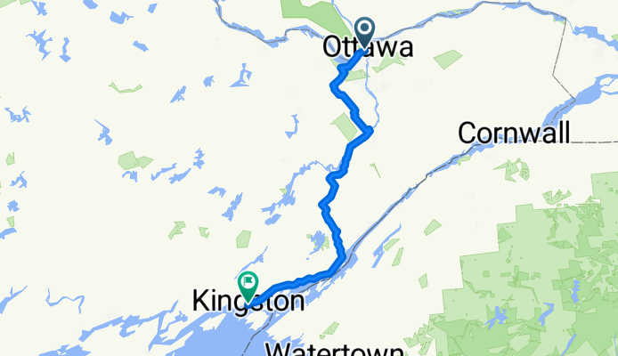
Ottawa to Kinhston (via Merrickville / Gananoque)
A cycling route starting in Ottawa, Ontario, Canada.
Overview
About this route
A fairly easy route from Ottawa to Kingston (via Merrickville, Athens, Gananogue). Relatively flat for most of the route, but there are a few good hills between Athens and the St-Lawrence Parkway. There are also a couple long hills between Gananogue and Kingston. Nevertheless, this route is still less hilly than others between Ottawa and Kingston. <br /><br />Except for a few crushed stone bicycle paths (which are suitable for road tires) between Ottawa and Stittsville, the entire route takes place on paved roads. Except for Highway 2 between Gananogue and Kingston, there are no paved shoulders on the roads for this route. However, most the roads are fairly quiet, and traffic should not be too much of an issue. There is a nice paved shoulder on highway 2. This route also make use of a bicycle path which runs along the St-Lawrence Parkway (and the 1000 Islands).
- -:--
- Duration
- 213.9 km
- Distance
- 367 m
- Ascent
- 331 m
- Descent
- ---
- Avg. speed
- 138 m
- Avg. speed
Route quality
Waytypes & surfaces along the route
Waytypes
Busy road
110.2 km
(52 %)
Quiet road
49.5 km
(23 %)
Surfaces
Paved
155.8 km
(73 %)
Unpaved
8.9 km
(4 %)
Asphalt
139 km
(65 %)
Paved (undefined)
14.3 km
(7 %)
Continue with Bikemap
Use, edit, or download this cycling route
You would like to ride Ottawa to Kinhston (via Merrickville / Gananoque) or customize it for your own trip? Here is what you can do with this Bikemap route:
Free features
- Save this route as favorite or in collections
- Copy & plan your own version of this route
- Sync your route with Garmin or Wahoo
Premium features
Free trial for 3 days, or one-time payment. More about Bikemap Premium.
- Navigate this route on iOS & Android
- Export a GPX / KML file of this route
- Create your custom printout (try it for free)
- Download this route for offline navigation
Discover more Premium features.
Get Bikemap PremiumFrom our community
Other popular routes starting in Ottawa
 Long Ride for Quickstart Autism
- Distance
- 65.3 km
- Ascent
- 91 m
- Descent
- 83 m
- Location
- Ottawa, Ontario, Canada
 Lac Leamy à Lac Pink
- Distance
- 32.5 km
- Ascent
- 216 m
- Descent
- 217 m
- Location
- Ottawa, Ontario, Canada
 PH to Steve's
- Distance
- 27.9 km
- Ascent
- 228 m
- Descent
- 246 m
- Location
- Ottawa, Ontario, Canada
 Italian Waters
- Distance
- 12.7 km
- Ascent
- 54 m
- Descent
- 55 m
- Location
- Ottawa, Ontario, Canada
 Route to 373 Laurier Avenue East, Ottawa ON K1N 8X6
- Distance
- 20.8 km
- Ascent
- 192 m
- Descent
- 190 m
- Location
- Ottawa, Ontario, Canada
 South of Blackburn
- Distance
- 19.1 km
- Ascent
- 61 m
- Descent
- 61 m
- Location
- Ottawa, Ontario, Canada
 Metcalfe St, Ottawa to Metcalfe St, Ottawa
- Distance
- 29.3 km
- Ascent
- 149 m
- Descent
- 149 m
- Location
- Ottawa, Ontario, Canada
 Route to Kichi Zībī Mīkan, Relais Kichi 27km
- Distance
- 27.4 km
- Ascent
- 225 m
- Descent
- 223 m
- Location
- Ottawa, Ontario, Canada
Open it in the app