

2020_Schladming-Panoramarunde
A cycling route starting in Schladming, Styria, Austria.
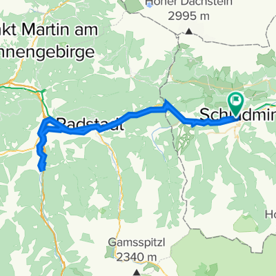
Overview
About this route
20.07.2020
- -:--
- Duration
- 55.1 km
- Distance
- 1,228 m
- Ascent
- 1,231 m
- Descent
- ---
- Avg. speed
- ---
- Avg. speed

Route quality
Waytypes & surfaces along the route
Waytypes
Track
20.4 km
(37 %)
Quiet road
12.6 km
(23 %)
Surfaces
Paved
29.8 km
(54 %)
Unpaved
22 km
(40 %)
Asphalt
29.5 km
(54 %)
Gravel
17.8 km
(32 %)
Continue with Bikemap
Use, edit, or download this cycling route
You would like to ride 2020_Schladming-Panoramarunde or customize it for your own trip? Here is what you can do with this Bikemap route:
Free features
- Save this route as favorite or in collections
- Copy & plan your own version of this route
- Sync your route with Garmin or Wahoo
Premium features
Free trial for 3 days, or one-time payment. More about Bikemap Premium.
- Navigate this route on iOS & Android
- Export a GPX / KML file of this route
- Create your custom printout (try it for free)
- Download this route for offline navigation
Discover more Premium features.
Get Bikemap PremiumFrom our community
Other popular routes starting in Schladming
 Schladming Bergstation Planei ins Tal
- Distance
- 36.8 km
- Ascent
- 419 m
- Descent
- 1,501 m
- Location
- Schladming, Styria, Austria
 MTB Runde. Ramsau - Hochwurzen - Fastenberg - Pichl - Ramsau
- Distance
- 53.3 km
- Ascent
- 1,912 m
- Descent
- 1,912 m
- Location
- Schladming, Styria, Austria
 sch-ram-filz-alt-rad-sch
- Distance
- 61.5 km
- Ascent
- 754 m
- Descent
- 753 m
- Location
- Schladming, Styria, Austria
 Ennstalrunde
- Distance
- 67.7 km
- Ascent
- 608 m
- Descent
- 609 m
- Location
- Schladming, Styria, Austria
 Schladming Flachau Rundweg
- Distance
- 61.3 km
- Ascent
- 224 m
- Descent
- 223 m
- Location
- Schladming, Styria, Austria
 Pichl - Ennsursprung
- Distance
- 32.8 km
- Ascent
- 557 m
- Descent
- 308 m
- Location
- Schladming, Styria, Austria
 Ramsau Tuerlwand
- Distance
- 32.8 km
- Ascent
- 1,350 m
- Descent
- 1,350 m
- Location
- Schladming, Styria, Austria
 Planai
- Distance
- 17.9 km
- Ascent
- 1,105 m
- Descent
- 96 m
- Location
- Schladming, Styria, Austria
Open it in the app