

Königsdorf
A cycling route starting in Altstadt Nord, North Rhine-Westphalia, Germany.
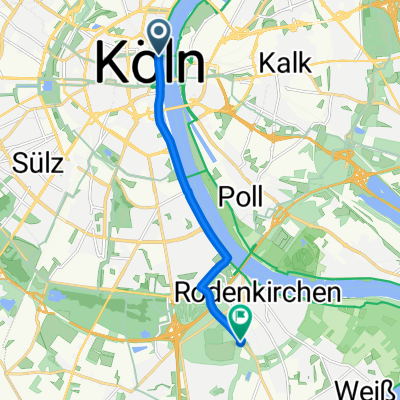
Overview
About this route
Königsdorf
Länge: 35. km- -:--
- Duration
- 37.3 km
- Distance
- 72 m
- Ascent
- 60 m
- Descent
- ---
- Avg. speed
- ---
- Avg. speed

Route highlights
Points of interest along the route
Point of interest after 21.6 km
Altes Brauhaus Königsdorf Aachener Strasse 616 50226 Frechen-Königsdorf Telefon (0 22 34) 6 15 81 Mo - Fr 11.00 - 14.30 Uhr und 17.00 Uhr bis Ende offen Sa - So durchgehend
Point of interest after 31.5 km
Stadtwaldgarten Aachener Str. 701 50933 Köln, Müngersdorf 0221 16869800 Öffnungszeiten..! Di.-Fr. von 17:00h - 24:00h, Sa. 16:00h - 24:00h und So. von 12:00h - 22:00h...!
Point of interest after 35.8 km
Biergarten am Aachener Weiher Richard-Wagner-Str. 50674 Köln Tel: 0221 50 00 614. Öffnungszeiten: täglich von 11.00 - 24.00 Uhr.
Continue with Bikemap
Use, edit, or download this cycling route
You would like to ride Königsdorf or customize it for your own trip? Here is what you can do with this Bikemap route:
Free features
- Save this route as favorite or in collections
- Copy & plan your own version of this route
- Sync your route with Garmin or Wahoo
Premium features
Free trial for 3 days, or one-time payment. More about Bikemap Premium.
- Navigate this route on iOS & Android
- Export a GPX / KML file of this route
- Create your custom printout (try it for free)
- Download this route for offline navigation
Discover more Premium features.
Get Bikemap PremiumFrom our community
Other popular routes starting in Altstadt Nord
 Im rechtsrheinischen Grüngürtel
- Distance
- 30.8 km
- Ascent
- 77 m
- Descent
- 67 m
- Location
- Altstadt Nord, North Rhine-Westphalia, Germany
 Forstbotanischer Garten, Köln
- Distance
- 7.5 km
- Ascent
- 41 m
- Descent
- 34 m
- Location
- Altstadt Nord, North Rhine-Westphalia, Germany
 Köln . kleine Rheinrunde
- Distance
- 25.9 km
- Ascent
- 130 m
- Descent
- 130 m
- Location
- Altstadt Nord, North Rhine-Westphalia, Germany
 CYCLING THE RHINE: Route 10A
- Distance
- 65.9 km
- Ascent
- 147 m
- Descent
- 138 m
- Location
- Altstadt Nord, North Rhine-Westphalia, Germany
 Breite - A4 - Deutz - Zoobrücke - Hbf
- Distance
- 20.5 km
- Ascent
- 141 m
- Descent
- 145 m
- Location
- Altstadt Nord, North Rhine-Westphalia, Germany
 Unter Käster 1, Köln nach Rochfordstraße 3, Haltern am See
- Distance
- 123 km
- Ascent
- 686 m
- Descent
- 696 m
- Location
- Altstadt Nord, North Rhine-Westphalia, Germany
 CYCLING THE RHINE: Route R11A
- Distance
- 59.2 km
- Ascent
- 97 m
- Descent
- 108 m
- Location
- Altstadt Nord, North Rhine-Westphalia, Germany
 Leichlingen Radtour
- Distance
- 62.3 km
- Ascent
- 172 m
- Descent
- 176 m
- Location
- Altstadt Nord, North Rhine-Westphalia, Germany
Open it in the app