

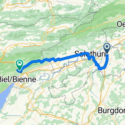
Solothurnstrasse 17, Luterbach nach Via Naviglio, Tenero
A cycling route starting in Luterbach, Canton of Solothurn, Switzerland.
Overview
About this route
- 14 h 31 min
- Duration
- 232.2 km
- Distance
- 10,355 m
- Ascent
- 10,586 m
- Descent
- 16 km/h
- Avg. speed
- ---
- Avg. speed
Route quality
Waytypes & surfaces along the route
Waytypes
Quiet road
64.3 km
(28 %)
Cycleway
62.6 km
(27 %)
Surfaces
Paved
126.2 km
(54 %)
Unpaved
5.9 km
(3 %)
Asphalt
121.6 km
(52 %)
Paved (undefined)
3.2 km
(1 %)
Continue with Bikemap
Use, edit, or download this cycling route
You would like to ride Solothurnstrasse 17, Luterbach nach Via Naviglio, Tenero or customize it for your own trip? Here is what you can do with this Bikemap route:
Free features
- Save this route as favorite or in collections
- Copy & plan your own version of this route
- Sync your route with Garmin or Wahoo
Premium features
Free trial for 3 days, or one-time payment. More about Bikemap Premium.
- Navigate this route on iOS & Android
- Export a GPX / KML file of this route
- Create your custom printout (try it for free)
- Download this route for offline navigation
Discover more Premium features.
Get Bikemap PremiumFrom our community
Other popular routes starting in Luterbach
 Luterbach - Schmiedmatte - Balsthal
- Distance
- 51.7 km
- Ascent
- 735 m
- Descent
- 735 m
- Location
- Luterbach, Canton of Solothurn, Switzerland
 Fabrikstrasse 1, Luterbach nach Amselweg 6, Biberist
- Distance
- 7.7 km
- Ascent
- 44 m
- Descent
- 19 m
- Location
- Luterbach, Canton of Solothurn, Switzerland
 Emmenspitz, Zuchwil nach Fabrikstrasse 2, Luterbach
- Distance
- 2.2 km
- Ascent
- 4 m
- Descent
- 8 m
- Location
- Luterbach, Canton of Solothurn, Switzerland
 test
test- Distance
- 39.6 km
- Ascent
- 473 m
- Descent
- 282 m
- Location
- Luterbach, Canton of Solothurn, Switzerland
 Quick and dirty Wynigerberge
- Distance
- 69.9 km
- Ascent
- 1,550 m
- Descent
- 1,529 m
- Location
- Luterbach, Canton of Solothurn, Switzerland
 Luterbach-Bolken-Asphalt - Luterbach-Bolken-Asphalt
- Distance
- 9.6 km
- Ascent
- 71 m
- Descent
- 19 m
- Location
- Luterbach, Canton of Solothurn, Switzerland
 Wydackerstrasse 34, Luterbach nach Oberburgstrasse 54D, Burgdorf
- Distance
- 25.5 km
- Ascent
- 165 m
- Descent
- 54 m
- Location
- Luterbach, Canton of Solothurn, Switzerland
 Luterbach - Weissenstein - Grenchen - Rüti - Oberwill
- Distance
- 57 km
- Ascent
- 812 m
- Descent
- 813 m
- Location
- Luterbach, Canton of Solothurn, Switzerland
Open it in the app