Premium Badge Download on the App Store Get it on Google Play Turn-by-turn Navigation Offline Maps Bike Type Optimized Routing Premium Maps Custom Bike Computer Export Routes Route Previews Fall Detection Premium Support

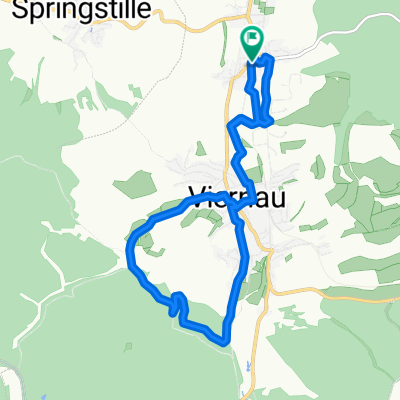
Cycling Route in Steinbach-Hallenberg, Free State of Thuringia, Germany

Steinbach Knüllfeld über Braukopfwiese - Stein 16 auf Rennsteig zum Grenzadler(Oberhof) zurück über Steinernem Häuschen

0
Open this route in the Bikemap app

Open this route in the Bikemap app

Open this route in Bikemap Web

Open this route in Bikemap Web

35 km
Distance
570 m
Ascent
566 m
Descent
-:-- h
Duration
-- km/h
Avg. Speed
--- m
Max. Elevation

About This Route

Start Kirche in Steinbach dann zum Knüllfeld hoch;  über Braukopfwiese am Fusse vom Ruppberg über Veilchenbrunnen zum Stein 16 - hier auf den Rennsteig entlang zum Grenzadler(Oberhof) zurück über Steinernem Häuschen, hier verlassen wir den Rennsteig zurück über Königsweg nach Steinbach Hallenberg. Reine Fahzeit ca 2 .. 2 1/2 Stunden.

This cycling route is ideal for: MTB

You will cycle on the following surfaces: Paved Unpaved Gravel

Customize this cycling route with the Bikemap route planner.

Make it yours!

Did you know? You can use this route as a template in our cycling route planner if you don't wish to start from scratch. Customize it based on your needs to plan your perfect cycling tour.

Open it in the app