

Bad Radkersburg-Maribor-Pohorje
A cycling route starting in Bad Radkersburg, Styria, Austria.
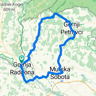
Overview
About this route
- -:--
- Duration
- 140.5 km
- Distance
- 1,323 m
- Ascent
- 1,324 m
- Descent
- ---
- Avg. speed
- ---
- Avg. speed

Continue with Bikemap
Use, edit, or download this cycling route
You would like to ride Bad Radkersburg-Maribor-Pohorje or customize it for your own trip? Here is what you can do with this Bikemap route:
Free features
- Save this route as favorite or in collections
- Copy & plan your own version of this route
- Sync your route with Garmin or Wahoo
Premium features
Free trial for 3 days, or one-time payment. More about Bikemap Premium.
- Navigate this route on iOS & Android
- Export a GPX / KML file of this route
- Create your custom printout (try it for free)
- Download this route for offline navigation
Discover more Premium features.
Get Bikemap PremiumFrom our community
Other popular routes starting in Bad Radkersburg
 Radkersburg Grenzstraße Straden Deutsch Goritz R2
- Distance
- 62.1 km
- Ascent
- 497 m
- Descent
- 500 m
- Location
- Bad Radkersburg, Styria, Austria
 Klöch Kellerstöckl
- Distance
- 12.3 km
- Ascent
- 158 m
- Descent
- 60 m
- Location
- Bad Radkersburg, Styria, Austria
 Kuzma Gorna Petrovci Murska Sobotka
- Distance
- 81.7 km
- Ascent
- 380 m
- Descent
- 378 m
- Location
- Bad Radkersburg, Styria, Austria
 Weinbergtour
- Distance
- 53.2 km
- Ascent
- 494 m
- Descent
- 494 m
- Location
- Bad Radkersburg, Styria, Austria
 Laafeld: Mureck, Diezendorf, Laafeld
- Distance
- 63 km
- Ascent
- 65 m
- Descent
- 65 m
- Location
- Bad Radkersburg, Styria, Austria
 Schloss Grad - Tour
- Distance
- 46.8 km
- Ascent
- 374 m
- Descent
- 371 m
- Location
- Bad Radkersburg, Styria, Austria
 Mountainbike Tour nach Slowenien
- Distance
- 40.7 km
- Ascent
- 683 m
- Descent
- 680 m
- Location
- Bad Radkersburg, Styria, Austria
 Radkersburg - Gorican
- Distance
- 80.9 km
- Ascent
- 32 m
- Descent
- 98 m
- Location
- Bad Radkersburg, Styria, Austria
Open it in the app