

CM 1988 Bike
A cycling route starting in Randogne, Valais, Switzerland.
Overview
About this route
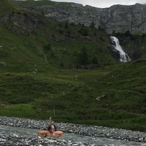
Ce parcours très exigeant, fléché pour les Championnats du Monde de mountain bike en 1988, vous permettra de tester votre forme physique, tout en profitant du site naturel exceptionnel d’Aminona.
- 4 h 46 min
- Duration
- 18.4 km
- Distance
- 1,065 m
- Ascent
- 1,062 m
- Descent
- 3.9 km/h
- Avg. speed
- ---
- Avg. speed
Route quality
Waytypes & surfaces along the route
Waytypes
Track
10.5 km
(57 %)
Quiet road
4.1 km
(22 %)
Surfaces
Paved
6.4 km
(35 %)
Unpaved
9.6 km
(52 %)
Gravel
7.1 km
(39 %)
Asphalt
6.4 km
(35 %)
Continue with Bikemap
Use, edit, or download this cycling route
You would like to ride CM 1988 Bike or customize it for your own trip? Here is what you can do with this Bikemap route:
Free features
- Save this route as favorite or in collections
- Copy & plan your own version of this route
- Sync your route with Garmin or Wahoo
Premium features
Free trial for 3 days, or one-time payment. More about Bikemap Premium.
- Navigate this route on iOS & Android
- Export a GPX / KML file of this route
- Create your custom printout (try it for free)
- Download this route for offline navigation
Discover more Premium features.
Get Bikemap PremiumFrom our community
Other popular routes starting in Randogne
 crans - Erschmatt, Granges, Crans
- Distance
- 81.4 km
- Ascent
- 1,858 m
- Descent
- 1,856 m
- Location
- Randogne, Valais, Switzerland
 2.2 .
2.2 .- Distance
- 22.1 km
- Ascent
- 1,444 m
- Descent
- 1,457 m
- Location
- Randogne, Valais, Switzerland
 Aminona La Tièche Violettes
- Distance
- 20.7 km
- Ascent
- 1,020 m
- Descent
- 1,024 m
- Location
- Randogne, Valais, Switzerland
 Crans Montana - Magic Forest WK
- Distance
- 40.1 km
- Ascent
- 4,550 m
- Descent
- 4,550 m
- Location
- Randogne, Valais, Switzerland
 CM 1988 Bike
- Distance
- 18.4 km
- Ascent
- 1,065 m
- Descent
- 1,062 m
- Location
- Randogne, Valais, Switzerland
 cascades
- Distance
- 14.2 km
- Ascent
- 477 m
- Descent
- 701 m
- Location
- Randogne, Valais, Switzerland
 Montana-Sanetsch-Montana
- Distance
- 100.5 km
- Ascent
- 2,705 m
- Descent
- 2,713 m
- Location
- Randogne, Valais, Switzerland
 20150325_101736.gpx
- Distance
- 8 km
- Ascent
- 320 m
- Descent
- 326 m
- Location
- Randogne, Valais, Switzerland
Open it in the app