Premium Badge Download on the App Store Get it on Google Play Turn-by-turn Navigation Offline Maps Bike Type Optimized Routing Premium Maps Custom Bike Computer Export Routes Route Previews Fall Detection Premium Support

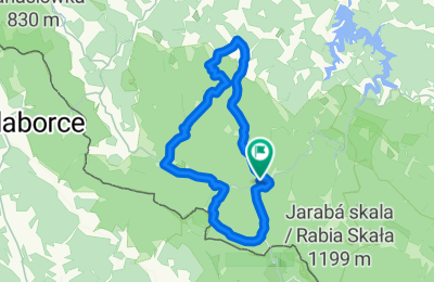
Cycling Route in Cisna, Subcarpathian Voivodeship, Poland

Trasa rowerowa "Przełęcz Żebrak"

0
Open this route in the Bikemap app

Open this route in the Bikemap app

Open this route in Bikemap Web

Open this route in Bikemap Web

73 km
Distance
1185 m
Ascent
1185 m
Descent
-:-- h
Duration
-- km/h
Avg. Speed
--- m
Max. Elevation

About This Route

Jest to trasa oznaczona kolorem niebieskim. Start i meta: schronisko pod Honem i kolejno Roztoki Górna-Solinka-Żubracze-Wola Michowa-Przełęcz Żebrak-Rabe (tu możliwość zjechania prosto do pętli bieszczackiej)-Roztoki Dolne-Mchawa-Baligród-Jabłonki-Cisna. Czas przejazdu 3h40min, średnia prędkość 16km/h, max 61km/h.

This cycling route is ideal for: MTB

You will cycle on the following surfaces: Paved Unpaved Gravel

Customize this cycling route with the Bikemap route planner.

Make it yours!

Did you know? You can use this route as a template in our cycling route planner if you don't wish to start from scratch. Customize it based on your needs to plan your perfect cycling tour.

Open it in the app