

Wildsaumarathon 2010
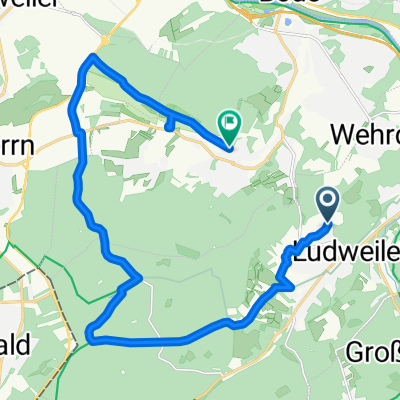
A cycling route starting in Ludweiler-Warndt, Saarland, Germany.
Overview
About this route
<span style="color: #000000;"><font face="Arial"><span style="font-size: 8pt; mso-bidi-font-family: Arial;">Schloßplatzschule</span><span style="font-size: 8pt; mso-bidi-font-family: Arial;"> – ST Hammergraben - Velsen - Bauerneck - UpH - DH - UpH zum Denkmal Hirzeckberg – weiter UpH zur Leitungs-trasse - DH zum Ehrengrundweiher + Umrundung - UpH zum Hallerkopf mit Marienkapelle - Weiter über Hohberg UpH zum Hühnerscherberg - DH Leitungstrasse – Fürstenhangpassage – DH Fürstenbrunnenbach – UpH und Querung Siedlung FH – UpH östl Fürstenhang ST bis Querung L163 - Forstwege Stiftswald bis Schafbach-ST+DH Schafbachweiher - Querung Rossel und Ludweiler Strasse - UpH zum Sportplatz GR - VP </span></font></span>
<span style="font-size: 8pt; mso-bidi-font-family: Arial;"><span style="color: #000000; font-family: Arial;"> </span></span>
<span style="font-size: 8pt; mso-bidi-font-family: Arial;"><span style="color: #000000;"><font face="Arial">Mühlenbach-DH – UPH - DH D.i.W. - ST und Querung Warndtbahn - DH Grohbruchbachteich und UpH kl. Meisenberg - Meisental-DH nach Emmersweiler - UpH zum Sportplatz - Emmersweiler Köpfchen – ST Hirschelheck – DH Unters Wies – Sportplatz St. Nikolaus – ST bis L276 – Grundkaulen - Breitenacker - Birkenhof – Forstwege + ST-DH-Meyersloch - Mühlenweiher - UpH Neuer Kahlschlag - DH Alter Kahlschlag - ST UpH zur Carrière Freyming – Grenzweg - Aussichtsplattform - Steinberg - DH Karlsbrunn - durchs Weihertal – hohler Keller – Karlsbrunner Feld - Lange Schneise – ST-DH Abt.122 - Weiherdamm - VP</font></span></span>
<span style="font-size: 8pt; mso-bidi-font-family: Arial;"><span style="color: #000000; font-family: Arial;"> </span></span>
<span style="font-size: 8pt; mso-bidi-font-family: Arial;"><span style="color: #000000;"><font face="Arial">Juchhei - Wolfschneis - Kreuzwalder Weg – ST bis Florianshütte - DH Fuchsborn - Werbelner Bach - ST Wolfsdell Richtung Tierpark – Scheidwald - ST - Querung L280 - UpH Hahnenkopf – über Birkenkopf und Lauterbach zur Schloßplatzschule.</font></span></span>
- -:--
- Duration
- 60.1 km
- Distance
- 779 m
- Ascent
- 777 m
- Descent
- ---
- Avg. speed
- ---
- Avg. speed

Continue with Bikemap
Use, edit, or download this cycling route
You would like to ride Wildsaumarathon 2010 or customize it for your own trip? Here is what you can do with this Bikemap route:
Free features
- Save this route as favorite or in collections
- Copy & plan your own version of this route
- Sync your route with Garmin or Wahoo
Premium features
Free trial for 3 days, or one-time payment. More about Bikemap Premium.
- Navigate this route on iOS & Android
- Export a GPX / KML file of this route
- Create your custom printout (try it for free)
- Download this route for offline navigation
Discover more Premium features.
Get Bikemap PremiumFrom our community
Other popular routes starting in Ludweiler-Warndt
 Wildsaumarathon 2011
- Distance
- 63.1 km
- Ascent
- 738 m
- Descent
- 736 m
- Location
- Ludweiler-Warndt, Saarland, Germany
 Hausrunde
- Distance
- 12.2 km
- Ascent
- 90 m
- Descent
- 90 m
- Location
- Ludweiler-Warndt, Saarland, Germany
 Grube Velsen - Carrière de Freyming-Merlebach - Lauterbach - Ludweiler
- Distance
- 47.4 km
- Ascent
- 459 m
- Descent
- 445 m
- Location
- Ludweiler-Warndt, Saarland, Germany
 ficken
- Distance
- 13.5 km
- Ascent
- 127 m
- Descent
- 142 m
- Location
- Ludweiler-Warndt, Saarland, Germany
 Beaunier-Weg 3, Völklingen nach Beaunier-Weg 3, Völklingen
- Distance
- 18.3 km
- Ascent
- 320 m
- Descent
- 321 m
- Location
- Ludweiler-Warndt, Saarland, Germany
 Warndtweiher, Linslerhof u. zurück
- Distance
- 19.3 km
- Ascent
- 96 m
- Descent
- 158 m
- Location
- Ludweiler-Warndt, Saarland, Germany
 Hugenottenstraße 157, Völklingen nach Hugenottenstraße 157, Völklingen
- Distance
- 9.7 km
- Ascent
- 98 m
- Descent
- 99 m
- Location
- Ludweiler-Warndt, Saarland, Germany
 Wildsaumarathon 2011
- Distance
- 63.1 km
- Ascent
- 747 m
- Descent
- 745 m
- Location
- Ludweiler-Warndt, Saarland, Germany
Open it in the app