

Lukskesroute 40km
A cycling route starting in Hoeilaart, Flemish Region, Belgium.
Overview
About this route
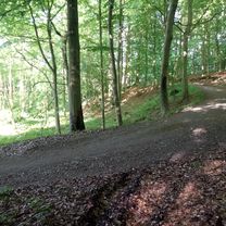
Mooie afwisselende route volledig door het zoniënwoud, het gootste bos van België, steeds goed bereidbaar. (ook na of tijdens hevig regenweer!) 43 km 850 hoogtemeters lekker snelle route Vertrek aan Station Groenendaal. Gemakkelijk bereikbaar via ring Brussel. Straat : GROENENDAALDESTEENWEG Postcode : 1560 Gemeente : HOEILAART Met dank aan Luc, voor uitstippelen van route ;)) Kan in de zomer ook met citybike
- -:--
- Duration
- 43 km
- Distance
- 544 m
- Ascent
- 545 m
- Descent
- ---
- Avg. speed
- ---
- Avg. speed
Route quality
Waytypes & surfaces along the route
Waytypes
Track
32.7 km
(76 %)
Path
6 km
(14 %)
Surfaces
Paved
7.1 km
(17 %)
Unpaved
27.7 km
(64 %)
Gravel
26.7 km
(62 %)
Asphalt
6.2 km
(14 %)
Continue with Bikemap
Use, edit, or download this cycling route
You would like to ride Lukskesroute 40km or customize it for your own trip? Here is what you can do with this Bikemap route:
Free features
- Save this route as favorite or in collections
- Copy & plan your own version of this route
- Sync your route with Garmin or Wahoo
Premium features
Free trial for 3 days, or one-time payment. More about Bikemap Premium.
- Navigate this route on iOS & Android
- Export a GPX / KML file of this route
- Create your custom printout (try it for free)
- Download this route for offline navigation
Discover more Premium features.
Get Bikemap PremiumFrom our community
Other popular routes starting in Hoeilaart
 MTB Zoniënwoud
- Distance
- 84.2 km
- Ascent
- 1,182 m
- Descent
- 1,180 m
- Location
- Hoeilaart, Flemish Region, Belgium
 Foret de Soignes - Sud Rev09
- Distance
- 27.2 km
- Ascent
- 736 m
- Descent
- 736 m
- Location
- Hoeilaart, Flemish Region, Belgium
 Official Hoeilaart Route, starting from Filip Sport
- Distance
- 24.3 km
- Ascent
- 210 m
- Descent
- 211 m
- Location
- Hoeilaart, Flemish Region, Belgium
 Picnic 52
- Distance
- 52 km
- Ascent
- 276 m
- Descent
- 274 m
- Location
- Hoeilaart, Flemish Region, Belgium
 Dolce to Château de La Hulpe
- Distance
- 8.7 km
- Ascent
- 122 m
- Descent
- 121 m
- Location
- Hoeilaart, Flemish Region, Belgium
 Terhulpensesteenweg 201, Watermaal-Bosvoorde to Chemin des Quatre Bras, La Hulpe
- Distance
- 14.4 km
- Ascent
- 155 m
- Descent
- 183 m
- Location
- Hoeilaart, Flemish Region, Belgium
 Tervueren Park- easy route
- Distance
- 7.8 km
- Ascent
- 61 m
- Descent
- 58 m
- Location
- Hoeilaart, Flemish Region, Belgium
 2025 Groenendaal - La Hulpe - Braine l'Alleud - Braine-le-Chateau - Clabecq - Huinzingen - Drogenbos - Berseel - Sint-Genesius-Rode - Groenendaal
- Distance
- 66.5 km
- Ascent
- 1,083 m
- Descent
- 1,086 m
- Location
- Hoeilaart, Flemish Region, Belgium
Open it in the app