

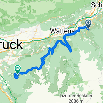
weer-glungezer-patschakofel
A cycling route starting in Terfens, Tyrol, Austria.
Overview
About this route
- -:--
- Duration
- 38.6 km
- Distance
- 2,064 m
- Ascent
- 720 m
- Descent
- ---
- Avg. speed
- ---
- Max. altitude
Continue with Bikemap
Use, edit, or download this cycling route
You would like to ride weer-glungezer-patschakofel or customize it for your own trip? Here is what you can do with this Bikemap route:
Free features
- Save this route as favorite or in collections
- Copy & plan your own version of this route
- Sync your route with Garmin or Wahoo
Premium features
Free trial for 3 days, or one-time payment. More about Bikemap Premium.
- Navigate this route on iOS & Android
- Export a GPX / KML file of this route
- Create your custom printout (try it for free)
- Download this route for offline navigation
Discover more Premium features.
Get Bikemap PremiumFrom our community
Other popular routes starting in Terfens
 weer-glungezer-patschakofel
- Distance
- 38.6 km
- Ascent
- 2,064 m
- Descent
- 720 m
- Location
- Terfens, Tyrol, Austria
 Bahnhof Weer - St. Jodok am Brenner
- Distance
- 62.8 km
- Ascent
- 2,802 m
- Descent
- 2,206 m
- Location
- Terfens, Tyrol, Austria
 woko Terfens Geisseljoch Tuxerjoch Terfens
- Distance
- 113.9 km
- Ascent
- 2,918 m
- Descent
- 2,913 m
- Location
- Terfens, Tyrol, Austria
![20220412-[R] Weißlahn Tenniscafe Terfens](https://media.bikemap.net/routes/12703080/staticmaps/in_8a52885d-b16f-4d49-b124-d5b8b676f9c6_400x400_bikemap-2021-3D-static.png) 20220412-[R] Weißlahn Tenniscafe Terfens
20220412-[R] Weißlahn Tenniscafe Terfens- Distance
- 26.7 km
- Ascent
- 135 m
- Descent
- 98 m
- Location
- Terfens, Tyrol, Austria
![20230102-[R] Weißlahn Sitzbank - Höttinger AU 52](https://media.bikemap.net/routes/12415978/staticmaps/in_6f4867b4-009c-47b1-bd42-de5c0daeb9ad_400x400_bikemap-2021-3D-static.png) 20230102-[R] Weißlahn Sitzbank - Höttinger AU 52
20230102-[R] Weißlahn Sitzbank - Höttinger AU 52- Distance
- 27.2 km
- Ascent
- 131 m
- Descent
- 98 m
- Location
- Terfens, Tyrol, Austria
 Jenbach - Gnadenwald - Hinterhorn
- Distance
- 63.1 km
- Ascent
- 1,085 m
- Descent
- 1,090 m
- Location
- Terfens, Tyrol, Austria
 Karwendeltour ab Terfens
- Distance
- 29.3 km
- Ascent
- 1,032 m
- Descent
- 1,032 m
- Location
- Terfens, Tyrol, Austria
 Giro del Tirolo 2016 - Tappa 4 (A)
- Distance
- 43.8 km
- Ascent
- 452 m
- Descent
- 452 m
- Location
- Terfens, Tyrol, Austria
Open it in the app