
Altenberger Dom
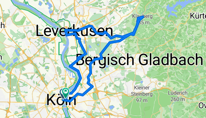
A cycling route starting in Altstadt Nord, North Rhine-Westphalia, Germany.
Overview
About this route
Tagestour: zum Altenberger Dom Dies Tagestour durch das Bergische Land, bietet ein ausgedehntes Rad-, Feld- und Waldwegenetz, das keine Wünsche offen lässt. Stille Wälder, weite Felder, entlegene Höfe und plätschernde Bäche. Von Köln aus bis Altenberg mit dem Fahrrad zu erkunden. Rucksackverpflegung evntl. Einkehr! Orte entlag der Rute: Köln Deutz, Buchheim, Dünnwald, Schildgen, Odenthal, Altenberg. Zurück: Odenthal, Osenau, Schlebuch, Alkenrath, Leverkusen, Wiesdorf, Flittard, Mülheim, Deutz. Treffpunkt: Wird bei der Anmeldung bekannt gegeben. Uhrzeit.: 09:30 Uhr Anmeldeschluß: 00.00.0000 Schwierigkeitsgrad: es wird nicht schneller 15 Km/h, ca.55 km Kosten: 5 € für Nichmitglieder. Tourenleiter Franco Sorressa Anmeldungen 0221/586172 Mobil.: 0178.5818740 Maximal 10 Radler-innen!!!
- -:--
- Duration
- 59.3 km
- Distance
- 150 m
- Ascent
- 143 m
- Descent
- ---
- Avg. speed
- ---
- Avg. speed

Route quality
Waytypes & surfaces along the route
Waytypes
Path
19.5 km
(33 %)
Quiet road
12.4 km
(21 %)
Surfaces
Paved
35.3 km
(60 %)
Unpaved
14 km
(24 %)
Asphalt
28.1 km
(48 %)
Gravel
7 km
(12 %)
Route highlights
Points of interest along the route

Point of interest after 23.7 km
Der Altenberger Dom ist die ehemalige Klosterkirche der seit 1133 von den Zisterziensern errichteten Abtei Altenberg. Bis 1511 fungierte das Gotteshaus auch als Grablege der Grafen und Herzöge von Berg sowie der Herzöge von Jülich-Berg.

Accommodation after 23.9 km
Gaststätte Küchenhof Carl-Mosterts-Str. 1 51519 Odenthal - Altenberg Telefon: 021 74 - 41 413 Geöffnet: Dienstag bis Sonntag ab 11:00 Uhr . Montag Ruhetag Mittagstisch: 12:00 Uhr bis 15:00 Uhr
Accommodation after 40.1 km
Chinesischer Mauer
Accommodation after 54.9 km
Gilden Brauhaus
Continue with Bikemap
Use, edit, or download this cycling route
You would like to ride Altenberger Dom or customize it for your own trip? Here is what you can do with this Bikemap route:
Free features
- Save this route as favorite or in collections
- Copy & plan your own version of this route
- Sync your route with Garmin or Wahoo
Premium features
Free trial for 3 days, or one-time payment. More about Bikemap Premium.
- Navigate this route on iOS & Android
- Export a GPX / KML file of this route
- Create your custom printout (try it for free)
- Download this route for offline navigation
Discover more Premium features.
Get Bikemap PremiumFrom our community
Other popular routes starting in Altstadt Nord
 Im rechtsrheinischen Grüngürtel
- Distance
- 30.8 km
- Ascent
- 77 m
- Descent
- 67 m
- Location
- Altstadt Nord, North Rhine-Westphalia, Germany
 Unter Käster 1, Köln nach Rochfordstraße 3, Haltern am See
- Distance
- 123 km
- Ascent
- 686 m
- Descent
- 696 m
- Location
- Altstadt Nord, North Rhine-Westphalia, Germany
 Forstbotanischer Garten, Köln
- Distance
- 7.5 km
- Ascent
- 41 m
- Descent
- 34 m
- Location
- Altstadt Nord, North Rhine-Westphalia, Germany
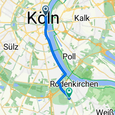
 Köln . kleine Rheinrunde
- Distance
- 25.9 km
- Ascent
- 130 m
- Descent
- 130 m
- Location
- Altstadt Nord, North Rhine-Westphalia, Germany
 Köln - Koblenz
- Distance
- 95.1 km
- Ascent
- 123 m
- Descent
- 104 m
- Location
- Altstadt Nord, North Rhine-Westphalia, Germany
 CYCLING THE RHINE: Route 10A
- Distance
- 65.9 km
- Ascent
- 147 m
- Descent
- 138 m
- Location
- Altstadt Nord, North Rhine-Westphalia, Germany
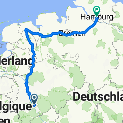 Köln-Hamburg
- Distance
- 628.6 km
- Ascent
- 1,061 m
- Descent
- 1,116 m
- Location
- Altstadt Nord, North Rhine-Westphalia, Germany
 Königsdorf
- Distance
- 35.2 km
- Ascent
- 82 m
- Descent
- 71 m
- Location
- Altstadt Nord, North Rhine-Westphalia, Germany
Open it in the app