

Talsperre Leibis
A cycling route starting in Neuhaus am Rennweg, Free State of Thuringia, Germany.
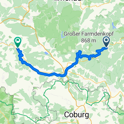
Overview
About this route
- -:--
- Duration
- 83.4 km
- Distance
- 175 m
- Ascent
- 814 m
- Descent
- ---
- Avg. speed
- ---
- Avg. speed
Route quality
Waytypes & surfaces along the route
Waytypes
Quiet road
24.3 km
(29 %)
Track
21 km
(25 %)
Surfaces
Paved
55.5 km
(67 %)
Unpaved
21.6 km
(26 %)
Asphalt
53.7 km
(64 %)
Loose gravel
10.4 km
(12 %)
Route highlights
Points of interest along the route
Point of interest after 1.9 km
Netto
Point of interest after 14.1 km
Imbiss
Point of interest after 32.1 km
Gaststätte
Continue with Bikemap
Use, edit, or download this cycling route
You would like to ride Talsperre Leibis or customize it for your own trip? Here is what you can do with this Bikemap route:
Free features
- Save this route as favorite or in collections
- Copy & plan your own version of this route
- Sync your route with Garmin or Wahoo
Premium features
Free trial for 3 days, or one-time payment. More about Bikemap Premium.
- Navigate this route on iOS & Android
- Export a GPX / KML file of this route
- Create your custom printout (try it for free)
- Download this route for offline navigation
Discover more Premium features.
Get Bikemap PremiumFrom our community
Other popular routes starting in Neuhaus am Rennweg
 Werra-Radweg gesamt Neuhaus-Hann.Münden
- Distance
- 325 km
- Ascent
- 160 m
- Descent
- 853 m
- Location
- Neuhaus am Rennweg, Free State of Thuringia, Germany
 2023 Tag 7 Coburg
- Distance
- 47 km
- Ascent
- 464 m
- Descent
- 893 m
- Location
- Neuhaus am Rennweg, Free State of Thuringia, Germany
 Werratal-Radweg
- Distance
- 309 km
- Ascent
- 194 m
- Descent
- 897 m
- Location
- Neuhaus am Rennweg, Free State of Thuringia, Germany
 RSSL_2012_4
- Distance
- 17.6 km
- Ascent
- 311 m
- Descent
- 333 m
- Location
- Neuhaus am Rennweg, Free State of Thuringia, Germany
 13.07.22 Neuhaus am Rennsteig-Themar
- Distance
- 66.7 km
- Ascent
- 257 m
- Descent
- 749 m
- Location
- Neuhaus am Rennweg, Free State of Thuringia, Germany
 Werratal Etappe1
- Distance
- 70.4 km
- Ascent
- 251 m
- Descent
- 745 m
- Location
- Neuhaus am Rennweg, Free State of Thuringia, Germany
 Werra 2008
- Distance
- 365 km
- Ascent
- 2,475 m
- Descent
- 3,133 m
- Location
- Neuhaus am Rennweg, Free State of Thuringia, Germany
 Rennsteig Radtour
- Distance
- 86.2 km
- Ascent
- 632 m
- Descent
- 1,166 m
- Location
- Neuhaus am Rennweg, Free State of Thuringia, Germany
Open it in the app