

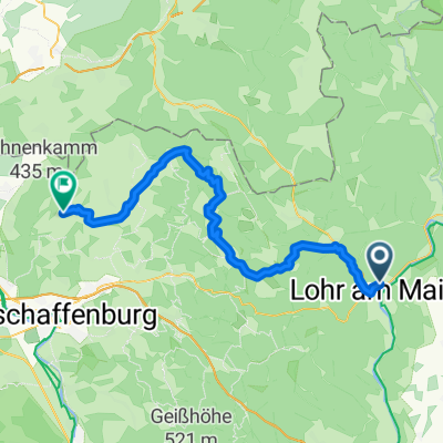
E1 - Bayrische Schanz
A cycling route starting in Lohr a. Main, Bavaria, Germany.
Overview
About this route
- -:--
- Duration
- 39.9 km
- Distance
- 856 m
- Ascent
- 855 m
- Descent
- ---
- Avg. speed
- ---
- Avg. speed
Route quality
Waytypes & surfaces along the route
Waytypes
Track
24.1 km
(60 %)
Road
10.1 km
(25 %)
Surfaces
Paved
4 km
(10 %)
Unpaved
20.5 km
(51 %)
Gravel
19.5 km
(49 %)
Paved (undefined)
3.9 km
(10 %)
Continue with Bikemap
Use, edit, or download this cycling route
You would like to ride E1 - Bayrische Schanz or customize it for your own trip? Here is what you can do with this Bikemap route:
Free features
- Save this route as favorite or in collections
- Copy & plan your own version of this route
- Sync your route with Garmin or Wahoo
Premium features
Free trial for 3 days, or one-time payment. More about Bikemap Premium.
- Navigate this route on iOS & Android
- Export a GPX / KML file of this route
- Create your custom printout (try it for free)
- Download this route for offline navigation
Discover more Premium features.
Get Bikemap PremiumFrom our community
Other popular routes starting in Lohr a. Main
 Lohr - Forsthäuser Tour - Hafenlohr - Lohr
- Distance
- 65.9 km
- Ascent
- 842 m
- Descent
- 841 m
- Location
- Lohr a. Main, Bavaria, Germany
 1ter Tag Lohr Mömbris
- Distance
- 56.5 km
- Ascent
- 542 m
- Descent
- 483 m
- Location
- Lohr a. Main, Bavaria, Germany
 Lohr am Main u.marktheidigfeld u.zurück
- Distance
- 61.6 km
- Ascent
- 285 m
- Descent
- 285 m
- Location
- Lohr a. Main, Bavaria, Germany
 Ausfahrt durch Lohr am Main
- Distance
- 27.1 km
- Ascent
- 364 m
- Descent
- 367 m
- Location
- Lohr a. Main, Bavaria, Germany
 LohramMain
- Distance
- 127.3 km
- Ascent
- 1,717 m
- Descent
- 1,732 m
- Location
- Lohr a. Main, Bavaria, Germany
 Von Lohr ins Sinntal
- Distance
- 47.4 km
- Ascent
- 77 m
- Descent
- 77 m
- Location
- Lohr a. Main, Bavaria, Germany
 Mainradweg Lohr am Main - Miltenberg
- Distance
- 78.9 km
- Ascent
- 0 m
- Descent
- 0 m
- Location
- Lohr a. Main, Bavaria, Germany
 Johnnys Sommertour 2008, 13.Tag
- Distance
- 153.7 km
- Ascent
- 685 m
- Descent
- 751 m
- Location
- Lohr a. Main, Bavaria, Germany
Open it in the app