
bm1 Pestfriedhof Konrad Zuse Vils
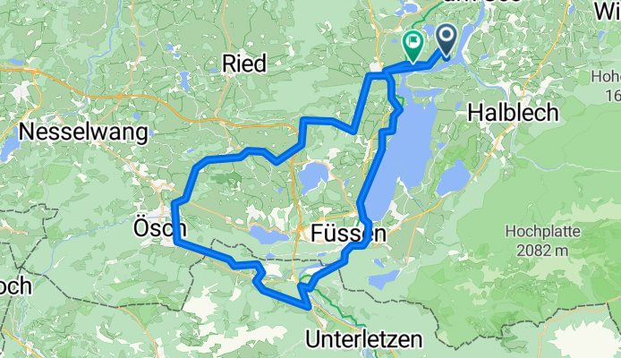
A cycling route starting in Prem, Bavaria, Germany.
Overview
About this route
- -:--
- Duration
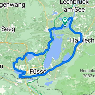
- 62.8 km
- Distance
- 558 m
- Ascent
- 539 m
- Descent
- ---
- Avg. speed
- ---
- Avg. speed
Route quality
Waytypes & surfaces along the route
Waytypes
Quiet road
26.3 km
(42 %)
Track
13.9 km
(22 %)
Surfaces
Paved
47.6 km
(76 %)
Unpaved
10.5 km
(17 %)
Asphalt
46.3 km
(74 %)
Gravel
8.8 km
(14 %)
Route highlights
Points of interest along the route
Point of interest after 27.8 km
Burg Vilsegg https://de.wikipedia.org/wiki/Burg_Vilsegg
Point of interest after 27.8 km
Kirche Vils
Point of interest after 27.9 km
historische Hammerschmiede Vils https://vilsart.eu
Point of interest after 28.5 km
St. Anna Kapelle
Point of interest after 42.4 km
Schloss Hopferau - Konrad Zuse
Continue with Bikemap
Use, edit, or download this cycling route
You would like to ride bm1 Pestfriedhof Konrad Zuse Vils or customize it for your own trip? Here is what you can do with this Bikemap route:
Free features
- Save this route as favorite or in collections
- Copy & plan your own version of this route
- Sync your route with Garmin or Wahoo
Premium features
Free trial for 3 days, or one-time payment. More about Bikemap Premium.
- Navigate this route on iOS & Android
- Export a GPX / KML file of this route
- Create your custom printout (try it for free)
- Download this route for offline navigation
Discover more Premium features.
Get Bikemap PremiumFrom our community
Other popular routes starting in Prem
 bm1 Pestfriedhof Konrad Zuse Vils
- Distance
- 62.8 km
- Ascent
- 558 m
- Descent
- 539 m
- Location
- Prem, Bavaria, Germany
 Schmuttersee_Neu
- Distance
- 57.7 km
- Ascent
- 285 m
- Descent
- 286 m
- Location
- Prem, Bavaria, Germany
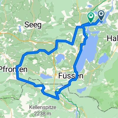
 Christusbund Ausfahrt Forggensee
- Distance
- 36.9 km
- Ascent
- 872 m
- Descent
- 870 m
- Location
- Prem, Bavaria, Germany
 TTT17 Immenst. Sonth. 118 Km 1100 Hm
- Distance
- 117.3 km
- Ascent
- 904 m
- Descent
- 904 m
- Location
- Prem, Bavaria, Germany
 TTT17 Marktobernd., Kempten, Immenstadt 120 Km 840 Hm
- Distance
- 123.9 km
- Ascent
- 745 m
- Descent
- 745 m
- Location
- Prem, Bavaria, Germany
 TTT17 Reute Garmisch ums Geierköpfle, Plansee (1)
- Distance
- 155.4 km
- Ascent
- 871 m
- Descent
- 871 m
- Location
- Prem, Bavaria, Germany
 A-TTT17 Füssen Reute Garmisch Oberammergau 120Km 850 Hm
- Distance
- 120.9 km
- Ascent
- 676 m
- Descent
- 676 m
- Location
- Prem, Bavaria, Germany
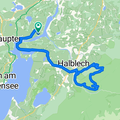
 J2 Prem Halblech HH Schwangau Alatsee
- Distance
- 54.2 km
- Ascent
- 324 m
- Descent
- 324 m
- Location
- Prem, Bavaria, Germany
Open it in the app